
- trip code
LTHG-20
- difficulty
Moderate
- Trip Style
Group
- Start in
Kathmandu
- end in
Kathmandu
- group size
8-12
- max altitude
Lauribina La Pass, 4,610 m / 15,124 ft
- Accommodation
teahouses, local lodges
- Best Season
Spring (March to May) and Autumn (September to November)
Overview
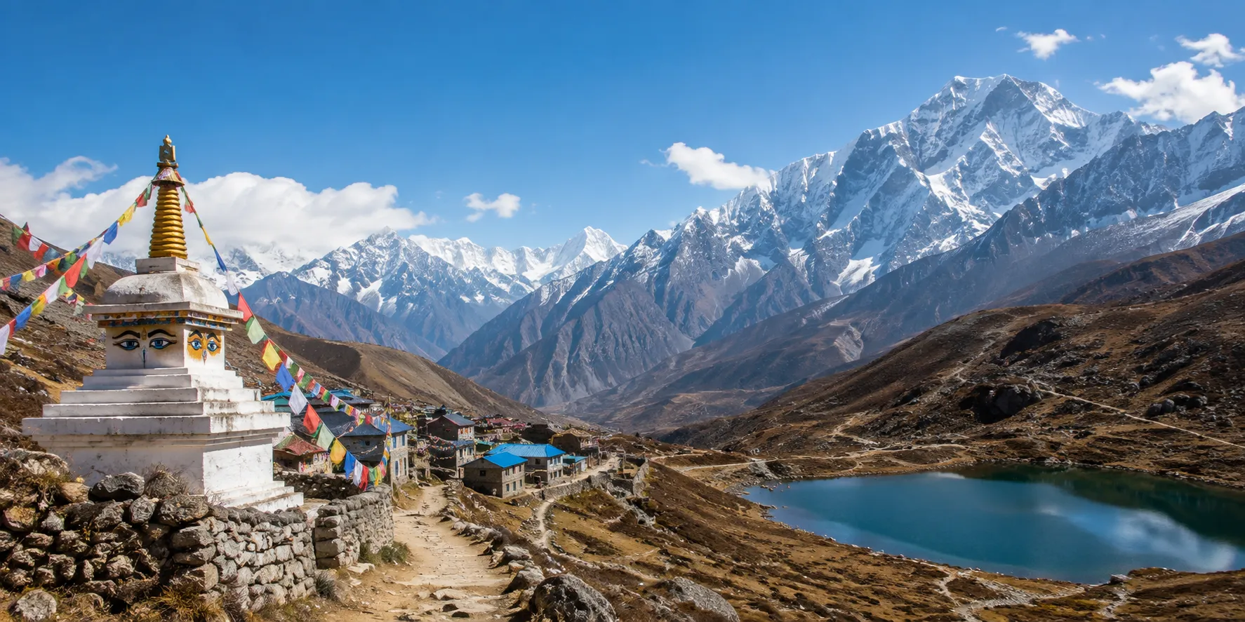
The Langtang Valley, Tamang Heritage, and Gosaikunda Lake Trek is a comprehensive 17-day Himalayan circuit in Nepal’s Rasuwa district. By combining three distinct sub-regions the cultural homestays of the Tamang Heritage Trail, the high-altitude glaciers of the Langtang Valley, and the sacred alpine lakes of Gosaikunda it delivers an all-in-one trek without the heavy commercial crowd of the Everest or Annapurna regions. The trail ranges in altitude from 1,460 meters at Syabrubesi to high-point viewpoints reaching 4,380 meters at Gosaikunda Lake and 4,984 meters at Tserko Ri.
Langtang Valley, Tamang Heritage and Gosaikunda Trek at a Glance
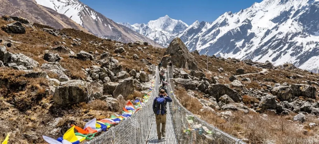
The Langtang Valley, Tamang Heritage Trail, and Gosaikunda Lake Trek is a complete Langtang-region circuit that combines Tamang villages, Buddhist heritage, forest trails, Kyanjin Gompa, Himalayan views, sacred alpine lakes, and Lauribina La Pass. It is best for trekkers who have more than two weeks and want a culturally immersive route rather than a short mountain view trek.
The complete journey usually begins with a road journey from Kathmandu to Syabrubesi. It follows the Tamang Heritage Trail through Gatlang, Tatopani, Thuman, Nagthali, and Briddim, then joins the main Langtang Valley route to Lama Hotel, Langtang Village, and Kyanjin Gompa. From there, the trek continues through Thulo Syabru and Sing Gompa to Gosaikunda Lake before crossing Lauribina La and descending through the Helambu side.
The route is demanding because it combines multiple trekking regions, repeated uphill and downhill walking, and high-altitude travel. It is not technical climbing, but it requires good physical preparation, a flexible itinerary, and careful altitude management.
Key trek facts
- Trek duration: 17 to 20 days, depending on route pacing, Kathmandu nights, and contingency days.
- Starting point: Syabrubesi, reached by road from Kathmandu.
- Finishing point: Sundarijal, Helambu, Dhunche, or Syabrubesi, depending on the itinerary.
- Highest overnight stop: Gosaikunda Lake at approximately 4,380 m.
- Highest trail point: Lauribina La Pass at approximately 4,610 m.
- Main cultural region: Tamang villages of Rasuwa and Helambu.
- Accommodation style: Teahouses, village lodges, and selected homestay-style stays.
- Best trekking seasons: Spring, March to May, and autumn, September to November.
Why this combined trek is worth doing
This trek is worth doing because it delivers three distinct travel experiences in a single route: Tamang cultural heritage, the high Himalayan valley of Langtang, and the sacred alpine landscape of Gosaikunda. Instead of simply walking to a viewpoint and returning on the same trail, trekkers move through changing communities, forests, valleys, ridges, lakes, and high passes.
The Tamang Heritage Trail makes the journey culturally richer. Villages such as Gatlang, Tatopani, Thuman, Nagthali, and Briddim offer opportunities to see traditional stone houses, Buddhist prayer flags, monasteries, local farming, village hospitality, and regional food. Tatopani also adds a hot-spring experience, while Nagthali is valued for its ridge-top Himalayan views.
The Langtang Valley section adds the classic mountain scenery: Langtang River forests, yak pastures, Langtang Village, Kyanjin Gompa, glaciers, and viewpoints such as Kyanjin Ri or Tserko Ri. Gosaikunda then changes the atmosphere completely, replacing the broad valley with sacred lakes, exposed high-altitude terrain, and the challenge of Lauribina La Pass.
For travelers choosing between the standard Langtang Valley Trek and the longer combination route, the decision is simple: choose Langtang Valley alone if you have limited time; choose the combined itinerary if cultural depth, a sacred lake, and a high-pass crossing matter as much as mountain views.
Route, duration and realistic pacing
A well-paced Langtang Valley, Tamang Heritage, and Gosaikunda itinerary takes 17 to 20 days. This duration is not excessive; it allows time for cultural exploration, gradual altitude gain, acclimatization at Kyanjin Gompa, and a safe approach to Gosaikunda and Lauribina La.
A shorter itinerary may be possible for highly experienced trekkers, but cutting too many days can make the trip unnecessarily exhausting. The most important days to protect are the Kyanjin Gompa acclimatization day and the high-altitude Gosaikunda section. A traveller who reaches the pass tired, dehydrated, or poorly acclimatized has a less safe and less enjoyable experience.
A practical route division looks like this:
- Tamang Heritage Trail: About 3 to 4 trekking days.
- Langtang Valley to Kyanjin Gompa: About 5 to 6 days, including acclimatization.
- Thulo Syabru to Gosaikunda and Lauribina La: About 4 to 5 days.
- Helambu-side exit or return journey: About 2 to 3 days.
- Kathmandu logistics: 2 to 3 days for arrival, preparation, road travel, and departure buffer.
The Langtang–Gosaikunda route alone is frequently packaged in 14- to 16-day versions. Adding the Tamang Heritage Trail creates a longer itinerary, but it makes the journey more distinctive and more valuable for visitors seeking culture alongside trekking.
Difficulty, altitude and fitness
The trek is moderate to strenuous. Fit beginners can do it with proper preparation, a guide, and an itinerary that does not rush the ascent, but it should not be presented as an easy trek. The challenge comes from consecutive trekking days, uneven stone trails, repeated ascents and descents, changing weather, and elevations above 4,000 m.
Most days require approximately 4 to 7 hours of walking. The Gosaikunda to Ghopte day via Lauribina La is usually the most difficult day because trekkers cross the highest pass, walk on exposed high-altitude terrain, and then make a long descent. Depending on weather, snow, and group pace, this day can take 6 to 8 hours.enticinghimalayas+1
The route includes three key elevation points:
- Kyanjin Gompa: Approximately 3,870 m.
- Gosaikunda Lake: Approximately 4,380 m.
- Lauribina La Pass: Approximately 4,610 m.
Trekkers may hike higher during the Kyanjin Gompa acclimatization day if they choose Kyanjin Ri or Tserko Ri. Those viewpoint hikes should be described as optional acclimatization hikes, not compulsory itinerary stages, because the appropriate choice depends on weather, fitness, and how each traveler feels at altitude.explorehimalaya+2
Acclimatization and altitude safety
Altitude sickness is a serious consideration on this route because it climbs from Kathmandu at roughly 1,400 m to Gosaikunda at around 4,380 m, before crossing Lauribina La at about 4,610 m. Physical fitness helps with trekking stamina, but it does not prevent altitude illness.
The safest strategy is to walk slowly, drink enough fluids, eat regular meals, avoid alcohol at high elevation, and include an acclimatization day at Kyanjin Gompa. Trekkers should not climb higher if they have concerning symptoms, and they should never continue uphill when symptoms are getting worse.
Symptoms that require immediate communication with the guide include severe or persistent headache, vomiting, dizziness, loss of coordination, confusion, chest tightness, shortness of breath at rest, and unusual exhaustion. The safest response to worsening altitude symptoms is to stop ascending and descend with assistance when necessary.
A trustworthy trekking company should never guarantee that a traveller will reach the pass. Weather, snow, health, and local trail conditions can require changes to the itinerary. This transparency improves safety and demonstrates experience based travel guidance.
Lauribina La Pass and Gosaikunda Lake
Lauribina La Pass is the physical and scenic highlight of the Gosaikunda section. At about 4,610 m, it is the highest point on the standard route and requires an early start from the Gosaikunda area. The pass is not normally a technical climbing route during stable trekking seasons, but high altitude and weather exposure make it demanding.
The trail may be affected by strong wind, cold, snow, ice, fog, and rapidly changing visibility. Trekkers should carry a waterproof outer layer, warm insulation, gloves, a warm hat, sunglasses, sunscreen, water, snacks, and a headlamp in their own daypack. Footwear should be broken in before the trek; new boots often cause blisters during long descents.
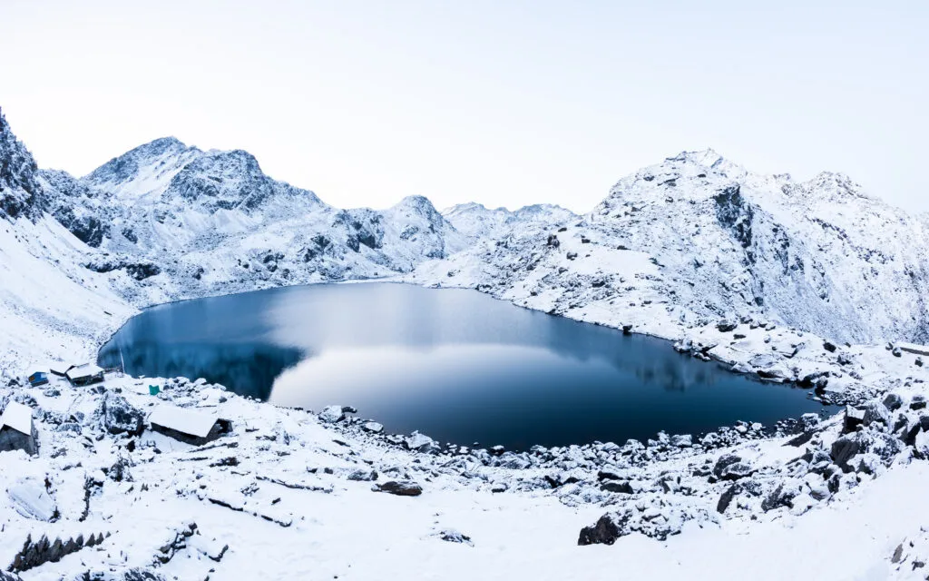
Gosaikunda Lake is more than a viewpoint. It is an important pilgrimage site for Hindu and Buddhist communities, so visitors should behave respectfully around the lake. Do not litter, swim, interfere with religious offerings, or create excessive noise in sacred areas. Gosaikunda is approximately 4,380 m, which means accommodation is basic and nighttime temperatures can be very low.
Tamang Heritage Trail experience
The Tamang Heritage Trail is the cultural foundation of this itinerary. It gives travelers time in the villages of the Langtang region before they reach the more famous alpine sections. This is especially valuable for travelers who want meaningful local experiences, not only viewpoints and trekking statistics.
Gatlang introduces the village architecture and Tamang community setting. Tatopani provides natural hot springs and a slower cultural stop. Thuman is known for Tamang culture, Buddhist traditions, and traditional settlement character. Nagthali offers a higher ridge experience with wide views, while Briddim provides a quieter village stay before the route joins the Langtang Valley trail.
The Tamang Heritage Trail is generally less challenging in altitude than Gosaikunda, but it is not flat. It includes long days of climbing and descending between villages. This makes it suitable as an early conditioning section of the longer trek, provided the itinerary does not move too fast.
Guide, permits and solo trekking
For this trek, a licensed guide is strongly recommended. A guide helps with route navigation, permits, accommodation, trail changes, food ordering, local communication, weather decisions, and altitude monitoring. This support becomes particularly valuable in the remote and high sections between Sing Gompa, Gosaikunda, Lauribina La, and Ghopte.
Do not publish an unconditional statement that solo trekking is allowed. Nepal’s trekking regulations and local enforcement can change, and different sources may report different arrangements. Your page should state that travelers must confirm the latest guide and permit rules with the Nepal Tourism Board or a Nepal-registered trekking agency before departure.
The main permit normally associated with the region is the Langtang National Park entry permit. Recent sources commonly list it at NPR 3,000 for foreign nationals and NPR 1,500 for SAARC nationals, while TIMS rules and fees should be verified before booking because requirements may change. Include a visible “permit information last verified on” date on your published page.
Best time and seasonal conditions
The best time for the Langtang Valley, Tamang Heritage, and Gosaikunda Trek is spring, from March to May, and autumn, from September to November. These seasons usually offer the best balance of trail access, daylight, weather stability, and mountain visibility.
Autumn is popular for clear skies, dry conditions, and crisp mountain views. October is often considered one of the strongest months for the route. Spring is warmer at lower elevations and brings rhododendron blooms along forest sections, although afternoon clouds can develop.
Winter trekking is possible for experienced and well-equipped trekkers, but snow and ice can complicate the Gosaikunda and Lauribina La section. Trekkers should allow an extra contingency day and avoid making fixed onward travel plans immediately after the trek. During monsoon, rain, leeches, cloud cover, slippery trails, landslide risk, and road delays are more likely.
Transport and road access
The standard road approach begins in Kathmandu and ends at Syabrubesi. The drive usually takes around 7 to 9 hours, depending on traffic, road construction, weather, landslides, and the vehicle type. Local buses are lower-cost, while private jeeps are generally faster and more comfortable, especially for groups.
The final road sections can be rough, so travel times should always be written as estimates. Avoid promising a fixed arrival time for Syabrubesi. During monsoon or after major weather events, road conditions can change rapidly.
The trek can finish in different places depending on the chosen route. A full circuit often exits toward Helambu and Sundarijal before returning to Kathmandu. Some itineraries retrace the route through Dhunche or Syabrubesi instead. This flexibility should be clearly stated in the itinerary, because it affects total duration, transport arrangements, and pricing.
Accommodation, meals and connectivity
The route uses basic teahouses, village lodges, and some community or homestay-style accommodation. Trekkers should not expect luxury facilities in high-altitude locations. Rooms are usually simple, and bathrooms may be shared. During peak seasons, rooms can fill quickly, particularly around Kyanjin Gompa, Sing Gompa, and Gosaikunda.
Food is generally cooked fresh in the lodges. Common meals include dal bhat, noodles, soup, fried rice, potatoes, eggs, Tibetan bread, tea, and seasonal local dishes. Dal bhat is often a practical meal for trekking because it provides carbohydrates, lentils, vegetables, and usually extra servings.
Charging, Wi-Fi, hot showers, and mobile networks are available in some villages but should never be guaranteed. Services may cost extra, depend on solar power or local electricity, and become less reliable at high altitude. Advise travelers to carry cash, a power bank, offline maps, downloaded travel documents, and a backup communication plan.
Cost planning and cash
The full trek costs more than a standard Langtang Valley Trek because it has more trekking days, more meals and lodge nights, a longer guide and porter requirement, and a high-pass crossing. Cost varies by season, group size, transportation choice, accommodation standard, guide and porter arrangements, and whether permits are included.
Instead of giving one fixed price, divide the cost section into three traveler categories:
- International travelers: Quote in USD and show what is included and excluded.
- SAARC travelers: Show permit differences and a separate price range where applicable.
- Nepali travelers: Show domestic transport, permit, and food-cost estimates in NPR.
Trekkers should carry enough Nepalese rupees for snacks, hot drinks, charging, Wi-Fi, showers, tips, souvenirs, personal gear replacement, and emergencies. ATMs are not reliable after leaving Kathmandu, and mobile payment systems may not work consistently in remote villages. Crowd-sourced Reddit budgets can help identify cost concerns, but they should not be used as fixed pricing because meal costs and road fares change over time.
Packing and preparation
Pack for warm low-altitude walking, rain, wind, and cold conditions above 4,000 m. The most important principle is layering: trekkers should be able to add or remove clothing as conditions change throughout the day.
Essential trekking gear includes broken-in trekking boots, moisture-wicking base layers, a fleece, insulated jacket, waterproof jacket and trousers, gloves, warm hat, sunglasses, sunscreen, lip balm, trekking poles, headlamp, reusable water bottles, water-purification tablets or filter, power bank, and personal first-aid items.
Keep vital items in the personal daypack: passport copy, insurance details, cash, medications, water, snacks, waterproof layer, gloves, phone, and headlamp. If using a porter, do not place essential medicines or warm layers only in the porter bag.
For winter trips, add heavier insulation and seek guide advice about traction devices if snow or ice is expected around Gosaikunda and Lauribina La
Why Combine Langtang Valley, Tamang Heritage and Gosaikunda?
Combining these routes gives travelers a fuller story of the Langtang region. The Tamang Heritage Trail introduces the communities, traditions, and everyday life of the lower hills. Langtang Valley provides the classic Himalayan landscape of forests, yak pastures, glaciers, and high peaks. Gosaikunda adds a sacred high-altitude lake and the challenge of crossing a mountain pass.
The route works especially well because the landscape changes naturally day by day. You begin with stone houses, terraced fields, monasteries, and village trails. Later, you walk through rhododendron and pine forest, follow the Langtang River, pass yak grazing areas, and finally enter a stark alpine environment around Gosaikunda.
The Tamang Heritage Trail is what makes this itinerary different from a normal Langtang Valley Trek. Villages such as Gatlang, Tatopani, Thuman, Nagthali, and Briddim offer a more personal cultural experience. Tatopani’s natural hot springs, Nagthali’s ridge views, Buddhist prayer sites, local food, and Tamang hospitality add value before the high-altitude portion begins.
Choose this complete route if you want:
- A longer, more diverse Himalayan trekking holiday
- Both cultural villages and high mountain scenery
- A sacred-lake experience at Gosaikunda
- A challenging but non-technical high pass
- A route with more variety than an out-and-back Langtang Valley Trek
Choose Langtang Valley only if you have fewer days, prefer lower overall difficulty, or do not want to cross Lauribina La.
Route Map, Starting Point and Finishing Point
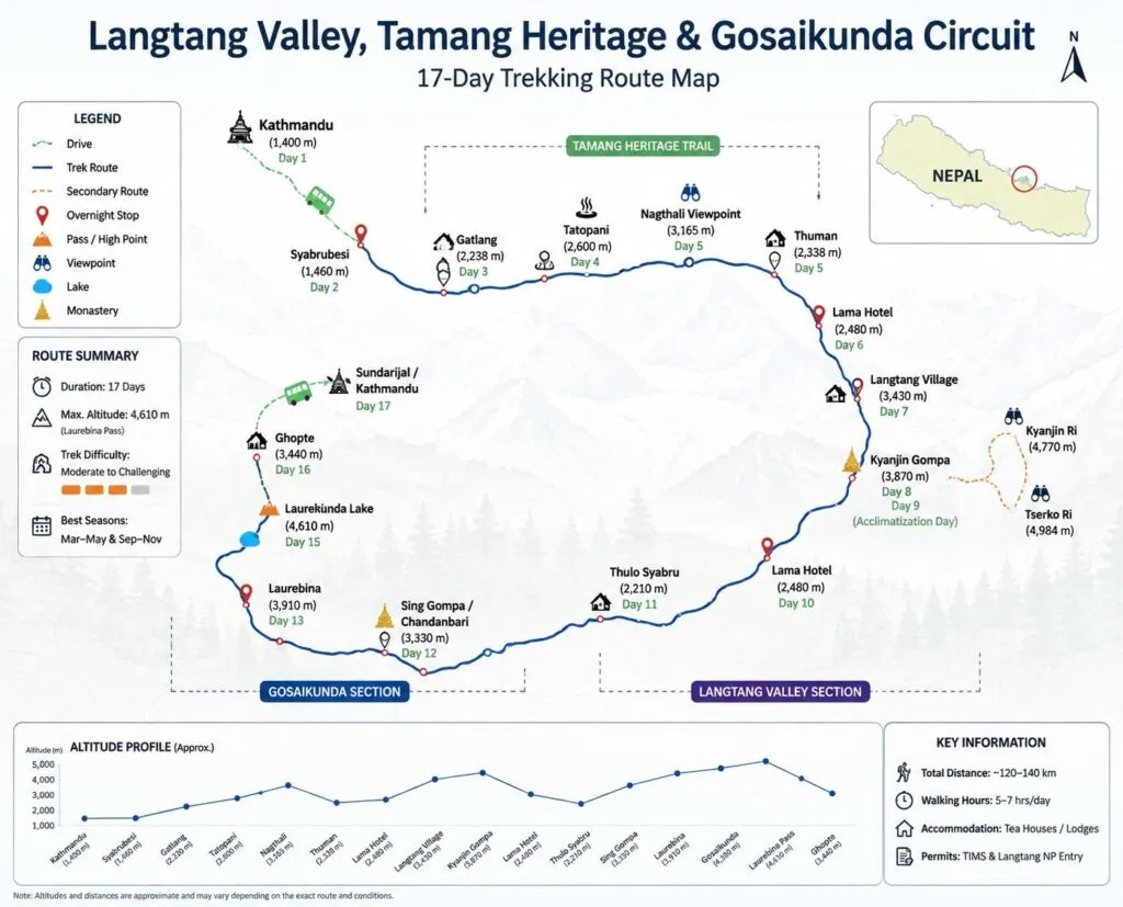
The trek normally begins with a drive from Kathmandu to Syabrubesi. From there, the route follows the Tamang Heritage Trail before joining the main Langtang Valley trail. After Kyanjin Gompa, trekkers descend and turn toward Thulo Syabru, Sing Gompa, Gosaikunda Lake, and Lauribina La Pass.
A practical full-route sequence is:
Kathmandu → Syabrubesi → Gatlang → Tatopani → Thuman → Nagthali → Briddim → Lama Hotel → Langtang Village → Kyanjin Gompa → Lama Hotel → Thulo Syabru → Sing Gompa → Laurebina Yak → Gosaikunda → Lauribina La → Ghopte → Tharepati → Gul Bhanjyang → Chisopani → Sundarijal → Kathmandu
Syabrubesi is the usual starting point for the Langtang Valley and Tamang Heritage Trail. It sits at roughly 1,500 m and is reached by road from Kathmandu. The complete circuit generally finishes at Sundarijal after descending from the Helambu side, followed by a short drive back to Kathmandu.
Some shorter route variations return through Dhunche or Syabrubesi instead. This choice affects the total duration, transport cost, and whether trekkers cross Lauribina La.
How Many Days Do You Need ?
For the full Langtang Valley, Tamang Heritage and Gosaikunda Trek, allow 17 to 20 days. This is the most realistic duration for travelers who want proper acclimatization, village exploration, reasonable daily walking hours, and a flexible buffer around the Gosaikunda section.
A shorter plan is possible, but it means removing important elements. Many 12- to 16-day itineraries cover Langtang Valley and Gosaikunda without the full Tamang Heritage Trail. A 10-day trek is normally too short for this complete circuit unless you are willing to use very long walking days and skip cultural stops.
A comfortable time breakdown looks like this:
- Kathmandu arrival and preparation: 1 to 2 days
- Kathmandu to Syabrubesi transport: 1 day
- Tamang Heritage Trail: 3 to 4 days
- Langtang Valley and Kyanjin Gompa: 5 to 6 days
- Acclimatization at Kyanjin Gompa: 1 day
- Gosaikunda and Lauribina La section: 4 to 5 days
- Helambu-side descent and Kathmandu return: 2 to 3 days
The main point is simple: do not remove the acclimatization day at Kyanjin Gompa just to make the package shorter. It provides a safer transition before you continue toward Gosaikunda and Lauribina La.
Trek Difficulty, Fitness and Daily Walking Hours
The complete route is moderate to strenuous. It does not require ropes, climbing experience, or technical mountaineering skills in normal trekking-season conditions, but it does require stamina, patience, and sensible pacing.
The Tamang Heritage Trail has repeated climbs and descents between villages. The Langtang Valley section becomes harder as altitude increases. The most physically demanding day is usually the crossing from Gosaikunda over Lauribina La Pass to Ghopte, where altitude, wind, cold, rocky terrain, and a long descent come together.
Most days involve around 4 to 7 hours of walking. The Lauribina La crossing day can take 6 to 8 hours or longer if there is snow, strong wind, fog, or a slower group pace.
This trek is suitable for fit beginners if they prepare well. Before arriving in Nepal, aim to build a routine that includes:
- Long walks on hills or stairs
- Cardio exercise three to five times per week
- Short hikes carrying a light daypack
- Leg-strength training for knees, glutes, and calves
- Practice walking in the trekking boots you plan to use
You do not need to be an athlete. However, you should be comfortable walking several days in a row on uneven trails while carrying water, warm clothing, rain gear, snacks, and personal essentials.
Gosaikunda Lake and Lauribina La Pass
Gosaikunda Lake is the spiritual and physical centerpiece of the upper part of the trek. It is a sacred alpine lake in Langtang National Park, located at approximately 4,380 m. For many travelers, arriving at the lake after days of forest, village, and mountain walking is the emotional highlight of the journey.
The lake is important to Hindu pilgrims and is also respected by Buddhist communities in the region. During Janai Purnima, the area becomes very busy with pilgrims. The atmosphere can be meaningful and vibrant, but accommodation can be crowded and services may be stretched.
Lauribina La Pass is the highest standard point on the route, commonly listed at around 4,610 m. It is usually crossed early in the morning after staying near Gosaikunda. The pass is not technical climbing, but it can be demanding because of altitude, exposure, cold, wind, snow, ice, and poor visibility.
Carry these items in your personal daypack on the pass day:
- Waterproof jacket and rain trousers
- Insulated jacket or warm mid-layer
- Gloves and warm hat
- Sunglasses and sunscreen
- Water and energy snacks
- Headlamp
- Personal medicine
- Phone, power bank, and emergency contact details
Never promise clients that the pass crossing is guaranteed. Winter snow, heavy rain, strong wind, health issues, or trail conditions can require a guide to change the plan.
Tamang Heritage Trail Villages and Culture
The Tamang Heritage Trail gives the trek its cultural identity. It takes travelers beyond the better-known Langtang Valley route and into communities where Tamang culture, Buddhist traditions, farming life, and mountain hospitality remain central to everyday life.
Gatlang is often the first major village on the trail. It is known for its traditional settlement layout, stone houses, terraced fields, and Tamang community atmosphere.
Tatopani is known for natural hot springs. After a day of walking, the warm-water experience can be a memorable and relaxing stop, depending on local access and conditions.
Thuman is a traditional village where travelers can observe local architecture, prayer flags, monasteries, and community life. It is one of the places where guides can add real value by explaining culture respectfully rather than treating villages as sightseeing stops.
Nagthali is a higher ridge area that offers broad Himalayan views in clear weather. It was historically used as a grazing area and is now valued as a scenic stop between the cultural villages.
Briddim offers a quieter village experience and is often used as a community-lodge or homestay-style stop before joining the Langtang Valley route.
Respect matters in every village. Ask before photographing people, dress modestly around monasteries, avoid wasting water, and buy local food or services where possible. Responsible trekking supports the communities that make the route possible.
Best Time, Weather, Winter and Monsoon
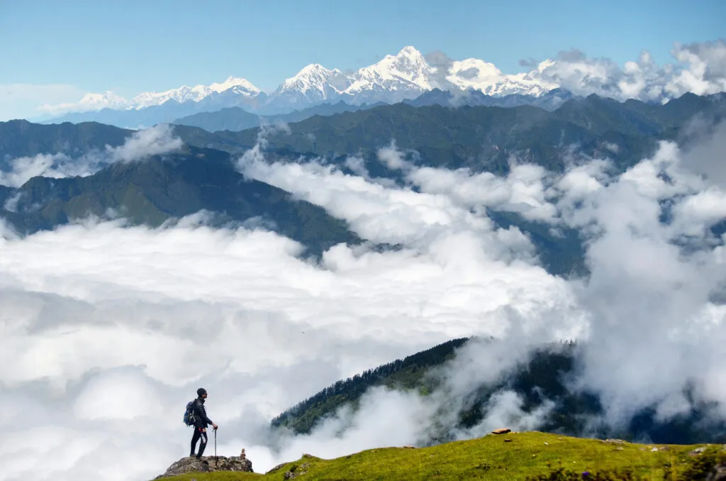
The best seasons for the complete trek are spring, from March to May, and autumn, from September to November. These periods usually provide the most reliable conditions for the high Gosaikunda and Lauribina La section.outdoorhimalayan+1
Spring: March to May
Spring brings warmer daytime temperatures, flowering rhododendrons in forest sections, and generally good trekking conditions. Afternoon clouds can build, especially later in the season, so morning views are often clearer.
Spring is a strong choice for travelers who enjoy greenery, flowers, and slightly warmer lower-elevation trekking.
Autumn: September to November
Autumn is often considered the most reliable period for clear skies, dry trails, sharp mountain views, and stable conditions after the monsoon. October is especially popular, so popular teahouses may fill earlier in the day.
This is the best option for travelers whose top priority is mountain visibility and a more reliable chance of crossing Lauribina La in stable conditions.
Winter: December to February
Winter trekking is possible, but it requires flexibility and stronger preparation. Gosaikunda may freeze, while snow and ice can affect Lauribina La. Nights can be extremely cold, and lodge services may be more limited.
Winter is better for experienced trekkers with good equipment, a reliable guide, extra contingency days, and no fixed onward flight immediately after the trek.
Monsoon: June to August
Monsoon brings green landscapes, fewer trekkers, and a quieter trail, but it also brings rain, clouds, leeches, slippery paths, landslide risk, and road delays. The full Gosaikunda and Lauribina La route is less predictable during this period.
If trekking in monsoon, keep the itinerary flexible and choose a guide or operator that provides honest, updated trail and road information.
Permits, TIMS, Guide Rules and Solo Trekking
The trek enters Langtang National Park, so a park-entry permit is required. According to Nepal Tourism Board information, the current Langtang National Park entry fee is NPR 3,000 for foreign nationals, NPR 1,500 for SAARC nationals, and NPR 100 for Nepali visitors. Children below 10 years are listed as free.
Nepal Tourism Board also includes Langtang Trek, Langtang Gosaikund Trek, Tamang Heritage Trek, and Tamang Heritage Langtang Trek in its TIMS information. Because TIMS processes, guide policies, and practical enforcement can change, verify the latest requirements through the Nepal Tourism Board or a registered Nepal trekking agency shortly before travel.
Sources : ntb.gov
For a full combination trek, a licensed guide is strongly recommended. A guide can help with:
- Route navigation and trail decisions
- Lodge bookings during busy seasons
- Monitoring altitude symptoms
- Weather decisions before Lauribina La
- Communication in villages and teahouses
- Permit handling and local procedures
- Explaining Tamang culture and Gosaikunda etiquette
- Managing itinerary changes during road delays or snowfall
Do not market solo trekking as automatically permitted. Travelers may find old blogs and Reddit reports describing independent trips, but regulations and local requirements need to be checked before the trek begins.
Kathmandu to Syabrubesi Transport and Road Conditions
The normal gateway journey is Kathmandu to Syabrubesi by road. Travelers can use a public bus, shared jeep, tourist vehicle, or private jeep.
Public buses are cheaper but usually slower and less comfortable. Shared jeeps are often quicker but can be crowded. Private jeeps are more convenient for families, groups, and travelers carrying extra luggage, though they cost more.
The drive generally takes around 7 to 9 hours, but this should always be presented as an estimate. Traffic, roadworks, rain, landslides, and vehicle type can change the journey time significantly.
The road is a normal and widely used approach route, but some parts can be rough. During monsoon, allow extra time and avoid booking a tight international-flight connection on the day after your return from the trek.
For Gosaikunda-only itineraries, many domestic trekkers begin from Dhunche instead. Dhunche is a practical starting point for travelers who have fewer days and want to focus on Gosaikunda without completing the full Langtang circuit.
Accommodation, Food, Wi-Fi, Charging and Hot Showers
The trek follows a teahouse model. Most overnight stops have basic lodges or village guesthouses, but standards vary widely by elevation, season, and location.
Expect simple twin rooms, shared bathrooms in many places, dining halls heated by a stove where available, and basic bedding. Carrying a sleeping bag or sleeping-bag liner is still a good idea because nights can be cold and extra blankets may not always be available.
Common overnight stops with teahouses include:
- Syabrubesi
- Gatlang
- Tatopani
- Thuman
- Briddim
- Lama Hotel
- Langtang Village
- Kyanjin Gompa
- Thulo Syabru
- Sing Gompa
- Laurebina Yak
- Gosaikunda
- Ghopte
- Tharepati
Food is simple, fresh, and practical for trekking. Typical menu items include dal bhat, vegetable curry, noodles, fried rice, soup, potatoes, eggs, Tibetan bread, momo, tea, coffee, and seasonal local dishes.
Dal bhat is often one of the best trekking meals because it provides rice, lentils, vegetables, and energy for long walking days. At high altitude, eat enough even if your appetite is lower than usual.
Wi-Fi, charging, hot showers, and mobile signal may be available at many stops, but they should never be guaranteed. Services can cost extra, depend on solar power or local electricity, and become less reliable near Gosaikunda and remote sections of the route.
Carry a power bank, offline maps, downloaded documents, cash, and a backup communication plan.
Detailed Cost Breakdown and Cash Requirements
The cost of this trek depends on your nationality, group size, season, transport choice, guide and porter arrangements, accommodation level, and package inclusions. A full 17- to 20-day itinerary will cost more than a short Langtang Valley or Gosaikunda trek because it includes more lodge nights, more meals, longer staff support, and a bigger route.
A transparent package-cost page should separate the following:
- International traveler package price
- SAARC traveler package price
- Nepali traveler domestic package price
- Private trek cost
- Group-joining trek cost
- Guide-only cost
- Guide and porter cost
- Budget for personal expenses
Your page should clearly state whether the price includes:
- Airport transfers
- Kathmandu hotel nights
- Transport to Syabrubesi
- Transport from Sundarijal or the trek endpoint
- Langtang National Park permit
- TIMS documentation, if currently required
- Licensed guide
- Porter service
- Accommodation during the trek
- Meals during the trek
- Insurance for guides and porters
- Government taxes
- Emergency support arrangements
Personal expenses normally include snacks, bottled drinks, alcoholic drinks, charging, Wi-Fi, hot showers, tips, souvenirs, personal gear, travel insurance, and extra hotel nights caused by delays.
Carry Nepalese rupees before leaving Kathmandu. Do not rely on ATMs or card payments in the trekking region. Bring extra cash for unexpected delays, extra meals, a change in transport plan, or additional lodge nights.
Packing List and Travel Insurance
The route moves from relatively warm lower hills to high, windy, and potentially freezing terrain around Gosaikunda and Lauribina La. Pack with a layering system rather than carrying one very heavy outfit.
Clothing
- Moisture-wicking trekking shirts
- Thermal base layers
- Fleece jacket or warm mid-layer
- Insulated down or synthetic jacket
- Waterproof jacket and rain trousers
- Trekking trousers
- Warm hat and sun hat
- Gloves or insulated mittens
- Trekking socks and spare socks
- Comfortable clothing for evenings
Footwear and trekking gear
- Broken-in waterproof trekking boots
- Camp shoes or sandals
- Trekking poles
- Daypack with rain cover
- Duffel bag for porter-carried luggage
- Sleeping bag or sleeping-bag liner
- Headlamp and spare batteries
- Reusable water bottles or hydration bladder
Health and personal items
- Water-purification tablets, filter, or UV purifier
- Sunscreen and lip balm
- Sunglasses with UV protection
- Personal medicine
- Blister plasters and basic first-aid supplies
- Hand sanitizer and toilet paper
- Quick-dry towel
- Power bank
- Passport copies and insurance details
International trekkers should have travel insurance that covers trekking at the actual maximum altitude planned. Lauribina La is approximately 4,610 m, and optional Tserko Ri hikes may reach close to 4,984 m. Check the policy’s altitude limit, emergency helicopter-evacuation terms, medical cover, and exclusions before purchase.
Responsible Trekking and Gosaikunda Etiquette
Responsible trekking protects the landscape, supports local communities, and respects the spiritual significance of Gosaikunda.
Gosaikunda is not simply a scenic lake. It is an important sacred destination for Hindu pilgrims and is also respected by Buddhist communities in the region. Treat the lakeshore, temples, prayer sites, and pilgrims with care.
Follow these principles:
- Carry reusable water bottles and minimize single-use plastic
- Do not leave waste on the trail or at the lake
- Do not swim in or pollute sacred water
- Ask before photographing local people, monks, or religious activities
- Dress respectfully in monasteries and villages
- Keep noise low around prayer sites and Gosaikunda Lake
- Support local lodges, guides, and village businesses
- Do not pressure guides, porters, or staff to continue in unsafe weather
- Follow Langtang National Park rules and local authority instructions
Nepal’s Department of National Parks and Wildlife Conservation states that valid entry permits are required to enter Langtang National Park.
Our TripAdvisor review :Tour Guide in Nepal
Content Reviewed By
Nepal Tour Guide Team Trek & Expedition Pvt. Ltd.
A licensed trekking and tour operator in Nepal, specializing in unforgettable Himalayan adventures across the Everest, Annapurna, Langtang, and Manaslu regions. Led by experienced local guides, we create safe, personalized, and responsible trekking experiences with expert knowledge of Nepal’s mountains, culture, and trail conditions.
Legal document:Tour Guide in Nepal

Trip highlights
- Explore the Tamang Heritage Trail and traditional mountain villages.
- Experience authentic Tamang culture, traditions, and village hospitality.
- Visit Gatlang, Tatopani, Thuman, Nagthali, and Briddim.
- Relax at the natural Tatopani hot springs.
- Trek through the beautiful Langtang Valley.
- Visit the historic Kyanjin Gompa.
- Enjoy spectacular Himalayan views from Kyanjin Ri or Tserko Ri.
- Experience the sacred alpine Gosaikunda Lake at 4,380 m.
- Cross the challenging Lauribina La Pass at approximately 4,610 m.
- Walk through forests of rhododendron, pine, oak, and bamboo.
- Experience diverse Himalayan landscapes, from lush valleys to high-altitude terrain.
- Explore Buddhist monasteries, prayer flags, chortens, and traditional settlements.
- Trek through Langtang National Park.
- Enjoy local Himalayan food, including dal bhat, noodles, momo, soup, and Tibetan bread.
- Complete an extended Himalayan journey combining culture, nature, spirituality, and mountain adventure.
itinerary
- day 1
Arrival in Kathmandu (1,400 m)
Airport arrival: Meet our representative at Tribhuvan International Airport. You will be welcomed and transferred to your hotel in Kathmandu.
Hotel check-in: After checking in, rest and recover from your journey. Your guide can assist with any immediate travel requirements.
Trip briefing: In the evening, meet your trekking guide for a detailed briefing about the Tamang Heritage, Langtang Valley, and Gosaikunda trek.
Preparation: Check your trekking equipment, clothing, footwear, backpack, medicines, travel documents, and insurance details.
Free time: If you feel comfortable after your flight, explore the nearby streets of Thamel.
Overnight: Hotel in Kathmandu.
Meals: Welcome dinner.
- day 2
Kathmandu sightseeing and trek preparation (1,400 m)
Permit preparation: Complete the required trekking permits and registrations with your trekking agency.
Gear check: Review your equipment with the guide and purchase or rent any missing items, such as down jackets, sleeping bags, trekking poles, gloves, or water-purification tablets.
Sightseeing option: Visit cultural attractions such as Boudhanath Stupa, Pashupatinath Temple, Swayambhunath, or Kathmandu Durbar Square.
Final briefing: Receive information about trail conditions, accommodation, meals, altitude sickness, responsible trekking, and emergency procedures.
Packing: Separate the equipment that will be carried by the porter from the small daypack you will carry yourself.
Overnight: Hotel in Kathmandu.
Meals: Breakfast.
- day 3
Kathmandu to Syabrubesi by road (1,503 m) – 7 to 9 hrs
Departure: Leave Kathmandu early in the morning after breakfast by local bus, tourist vehicle, private jeep, or shared jeep.
Driving route: Travel through Trishuli Bazaar and Dhunche before continuing toward Syabrubesi.
Landscape: Enjoy views of terraced fields, green hills, roadside villages, forests, and the Trishuli River.
Road conditions: The journey can be bumpy in some sections, especially after Dhunche. Travel time depends on traffic, weather, road maintenance, and vehicle type.
Arrival: Check in at a teahouse in Syabrubesi and prepare your trekking equipment for the next morning.
Trek preparation: Fill your water bottles, charge essential devices if possible, and keep your daypack ready.
Overnight: Teahouse in Syabrubesi.
Meals: Breakfast, lunch, and dinner.
- day 4
Syabrubesi to Gatlang (2,238 m) – 4 to 5 hrs
Trail start: Begin your first trekking day after breakfast and follow the trail away from Syabrubesi.
Trail nature: The route gradually climbs through terraced farmland, forests, and traditional hillside settlements.
Cultural experience: This is the beginning of the Tamang Heritage Trail, where you can observe local architecture, Buddhist symbols, prayer flags, and village life.
Village approach: Continue toward Gatlang along a scenic ridge and mountain trail.
Gatlang village: Explore the traditional Tamang settlement after checking into your lodge.
Evening activity: Walk through the village, visit local cultural sites, and learn about the community from your guide or host.
Overnight: Teahouse or community lodge in Gatlang.
Meals: Breakfast, lunch, and dinner.
- day 5
Gatlang to Tatopani (2,610 m) – 4 to 6 hrs
Morning departure: Leave Gatlang after breakfast and continue along the Tamang Heritage Trail.
Trail nature: The trail passes through forests, cultivated terraces, small settlements, and quiet hillside paths.
Landscape: Enjoy views of green valleys, mountain ridges, and the surrounding Tamang villages.
Elevation: The route includes gradual climbs and descents before reaching Tatopani.
Tatopani: The name means “hot water,” and the village is known for its natural hot springs.
Relaxation: Depending on local conditions and availability, relax in the hot springs after the walk.
Cultural experience: Enjoy locally prepared food and experience the hospitality of the Tamang community.
Overnight: Teahouse in Tatopani.
Meals: Breakfast, lunch, and dinner.
- day 6
Tatopani to Thuman and Nagthali (3,165 m) – 4 to 5 hrs
Trail nature: Today’s route climbs steadily from Tatopani toward Thuman and the higher ridge of Nagthali.
Thuman village: Stop at Thuman, a traditional Tamang village known for its cultural heritage, mountain views, Buddhist traditions, and local hospitality.
Village experience: Depending on the season, you may see cultural performances, local dances, or traditional music.
Ascent to Nagthali: Continue uphill through forest and open grazing areas toward Nagthali.
Mountain views: Nagthali offers impressive views of Langtang Himal, Ganesh Himal, and nearby mountain ranges on clear days.
Afternoon: Take a short walk around the ridge and enjoy the sunset if weather conditions are favorable.
Altitude note: Sleep slowly and drink plenty of water because this is the first night above 3,000 m.
Overnight: Simple teahouse or lodge in Nagthali.
Meals: Breakfast, lunch, and dinner.
- day 7
Nagthali to Briddim (2,240 m) – 4 to 5 hrs
Morning departure: Start the day with a descent from Nagthali through forested trails and hillside paths.
Trail nature: The route is generally less demanding in altitude than the previous day but includes uneven sections and gradual ups and downs.
Landscape: Walk through pine, rhododendron, and mixed woodland with views of rural settlements and mountain slopes.
Briddim village: Arrive at Briddim, a traditional Tamang village with stone houses, narrow lanes, Buddhist prayer flags, and a welcoming local community.
Cultural stay: Depending on the package arrangement, stay in a community lodge or homestay-style accommodation.
Village exploration: Learn about local traditions, food, farming, Buddhist culture, and daily life.
Overnight: Teahouse or community lodge in Briddim.
Meals: Breakfast, lunch, and dinner.
- day 8
Briddim to Lama Hotel (2,470 m) – 6 to 7 hrs
Trail connection: Leave Briddim and continue toward Lama Hotel, joining the main Langtang Valley trekking route.
Forest walk: Walk through dense forests of oak, rhododendron, bamboo, pine, and other Himalayan vegetation.
River views: The trail follows sections of the Langtang Khola and crosses small bridges and forest streams.
Wildlife: Keep an eye out for Himalayan birds, monkeys, and signs of wildlife within Langtang National Park.
Walking condition: This is a longer trekking day with several gradual climbs and descents.
Lama Hotel: Arrive at the small forest settlement and check into your teahouse.
Evening: Rest, hydrate, and prepare for the higher-altitude section of the Langtang Valley.
Overnight: Teahouse at Lama Hotel.
Meals: Breakfast, lunch, and dinner.
- day 9
Lama Hotel to Langtang Village (3,430 m) – 5 to 6 hrs
Morning trail: Continue climbing through the forest beside the Langtang River.
Trail stops: Pass through small settlements and rest points such as Riverside and Ghodatabela.
Changing landscape: As you gain altitude, the dense forest gradually opens into wider valleys, alpine meadows, and mountain terrain.
Mountain views: The views of Langtang Lirung and surrounding peaks become more prominent.
Langtang Valley: Continue along the broad valley toward Langtang Village.
Community visit: Learn about the history, resilience, and rebuilding of the local community after the 2015 earthquake.
Evening: Explore the village if you still have energy, but prioritize rest and hydration.
Overnight: Teahouse in Langtang Village.
Meals: Breakfast, lunch, and dinner.
- day 10
Langtang Village to Kyanjin Gompa (3,870 m) – 3 to 4 hrs
Short trekking day: Today is shorter in distance, allowing you to adjust gradually to higher altitude.
Trail nature: Follow the valley through open landscapes, yak pastures, stone walls, chortens, and Buddhist prayer flags.
Mountain scenery: Enjoy increasingly dramatic views of Langtang Lirung, Langshisha Ri, Dorje Lakpa, and surrounding peaks.
Kyanjin Gompa: Arrive at this high-altitude settlement, one of the main destinations of the Langtang Valley Trek.
Local attractions: Visit Kyanjin Gompa, explore the village, and visit the cheese factory if it is open.
Afternoon walk: Take a gentle walk around the valley but avoid strenuous climbing before the acclimatization day.
Overnight: Teahouse in Kyanjin Gompa.
Meals: Breakfast, lunch, and dinner.
- day 11
Acclimatization and exploration around Kyanjin Gompa (3,870 m)
Acclimatization purpose: Spend a second night at Kyanjin Gompa to help your body adjust to the altitude.
Viewpoint option: Depending on your fitness, weather, and guide’s recommendation, hike to Kyanjin Ri or Tserko Ri.
Kyanjin Ri: A shorter viewpoint option with excellent views of the surrounding peaks and glaciers.
Tserko Ri: A more demanding option that provides a higher viewpoint and broader Himalayan panorama.
Mountain experience: Enjoy views of Langtang Lirung, glaciers, high valleys, and dramatic Himalayan ridges.
Return: Descend back to Kyanjin Gompa for lunch or a late afternoon meal.
Altitude safety: Inform your guide immediately if you experience severe headache, nausea, dizziness, breathing difficulty, confusion, or unusual weakness.
Overnight: Teahouse in Kyanjin Gompa.
Meals: Breakfast, lunch, and dinner.
- day 12
Kyanjin Gompa to Lama Hotel (2,470 m) – 6 to 7 hrs
Descent begins: Retrace the trail through the Langtang Valley toward Lama Hotel.
Changing views: The same route looks different while descending, with broad alpine scenery gradually changing back into forests and river valleys.
Trail stops: Pass through Langtang Village and Ghodatabela before continuing downward.
Walking strategy: Descending can be hard on the knees, so use trekking poles and maintain controlled steps.
Lama Hotel: Arrive at your lodge and enjoy a warm meal after the long descent.
Rest: This is an important recovery evening before beginning the route toward Gosaikunda.
Overnight: Teahouse at Lama Hotel.
Meals: Breakfast, lunch, and dinner.
- day 13
Lama Hotel to Thulo Syabru (2,230 m) – 5 to 6 hrs
Route change: Leave the main Langtang Valley trail and follow the route toward Thulo Syabru.
Trail nature: Walk through forest, river valleys, suspension bridges, and hillside paths with several ascents and descents.
Village approach: The trail gradually climbs toward Thulo Syabru, a scenic Tamang settlement built along a ridge.
Mountain views: Enjoy views toward Ganesh Himal and the green hills of the Langtang region.
Cultural experience: Thulo Syabru is an excellent place to learn more about Tamang culture, local farming, and Buddhist traditions.
Preparation: Organize your daypack for the next section, which climbs toward Sing Gompa and Gosaikunda.
Overnight: Teahouse in Thulo Syabru.
Meals: Breakfast, lunch, and dinner.
- day 14
Thulo Syabru to Sing Gompa, Chandan Bari (3,250 m) – 4 to 5 hrs
Steady climb: Begin climbing through oak, pine, fir, hemlock, and rhododendron forests.
Trail nature: The ascent is continuous but manageable when taken at a slow, steady pace.
Forest scenery: Enjoy quiet woodland, mountain birds, occasional clearings, and views across the surrounding valleys.
Sing Gompa: Arrive at Chandan Bari, commonly known as Sing Gompa, and settle into the lodge.
Monastery visit: Visit the local Buddhist monastery and learn about its religious importance.
Local products: If available, try locally produced yak cheese and other mountain dairy products.
Altitude preparation: Drink water regularly and avoid alcohol as the route now moves above 3,000 m.
Overnight: Teahouse in Sing Gompa.
Meals: Breakfast, lunch, and dinner.
- day 15
Sing Gompa to Laurebina Yak (3,910 m) – 4 to 5 hrs
Higher trail: Leave the forest behind gradually as the trail climbs through more open and exposed mountain terrain.
Landscape: Walk across ridges, alpine slopes, and rocky paths with broad views of Langtang Himal, Ganesh Himal, and distant ranges.
Pacing: Maintain a slow pace and take regular breaks because the altitude is approaching 4,000 m.
Weather: Wind, clouds, and cold temperatures can appear quickly, especially in the afternoon.
Laurebina Yak: Arrive at the high settlement used as an overnight staging point before Gosaikunda.
Evening routine: Eat a warm dinner, prepare warm clothing, refill water, and sleep early.
Altitude monitoring: Report persistent headache, vomiting, severe fatigue, dizziness, or breathing difficulty to your guide.
Overnight: Simple teahouse in Laurebina Yak.
Meals: Breakfast, lunch, and dinner.
- day 16
Laurebina Yak to Gosaikunda Lake (4,380 m) – 4 to 5 hrs
Early start: Begin after breakfast and walk at a careful pace through high alpine terrain.
Trail nature: The route follows rocky ridges and open slopes with very little tree cover.
Sacred lakes: Pass smaller mountain lakes before reaching the main Gosaikunda Lake.
Gosaikunda: Arrive at the sacred alpine lake, which is important to Hindu and Buddhist pilgrims.
Cultural respect: Avoid swimming, littering, loud behavior, or disturbing religious offerings around the lake.
Photography: Clear weather may provide beautiful reflections and views of the surrounding peaks, while clouds can arrive quickly.
Evening conditions: Accommodation is basic, and nighttime temperatures can be very cold.
Overnight: Teahouse near Gosaikunda Lake.
Meals: Breakfast, lunch, and dinner.
- day 17
Gosaikunda to Ghopte via Lauribina La Pass (4,610 m) – 6 to 8 hrs
Early departure: Start early because this is the most demanding day of the trek and weather conditions are often better in the morning.
Pass approach: Climb gradually from Gosaikunda toward Lauribina La Pass through rocky, exposed terrain.
Highest point: Cross Lauribina La, commonly listed at approximately 4,610 m.
Safety: Follow your guide closely, walk slowly, keep warm layers accessible, and watch for snow, ice, strong wind, and low visibility.
Descent: After crossing the pass, descend through rugged terrain and continue toward the forests around Ghopte.
Long day: The combination of altitude, uneven trail, and sustained walking makes this a physically demanding day.
Arrival: Rest immediately after reaching Ghopte and drink fluids before dinner.
Overnight: Teahouse in Ghopte.
Meals: Breakfast, lunch, and dinner.
- day 18
Ghopte to Tharepati (3,640 m) – 5 to 6 hrs
Trail nature: Continue through forested hills, rocky paths, ridges, and quiet sections of the Helambu trekking route.
Elevation pattern: The route includes repeated climbs and descents, but the overall environment is more sheltered than the pass-crossing section.
Vegetation: As the trail moves through forest, observe rhododendron, pine, fir, and other Himalayan vegetation.
Tharepati: Arrive at the ridge settlement of Tharepati, an important junction in the Helambu region.
Views: On clear days, enjoy views toward Langtang and other Himalayan ranges.
Recovery: The lower altitude and quieter trail make this a good day to recover after the Lauribina La crossing.
Overnight: Teahouse in Tharepati.
Meals: Breakfast, lunch, and dinner.
- day 19
Tharepati to Gul Bhanjyang (2,140 m) – 5 to 6 hrs
Long descent: Leave Tharepati and descend through forested trails, hillside settlements, and traditional Helambu landscapes.
Changing environment: The air becomes warmer, vegetation becomes denser, and the trail gradually feels more settled and accessible.
Village scenery: Pass through local communities, terraced fields, and cultivated hillsides.
Gul Bhanjyang: Arrive at the village and check into a local teahouse.
Afternoon: Rest, enjoy the warmer conditions, and recharge cameras and mobile devices if electricity is available.
Final preparation: Confirm the next day’s walking and transport arrangements with your guide.
Overnight: Teahouse in Gul Bhanjyang.
Meals: Breakfast, lunch, and dinner.
- day 20
Gul Bhanjyang to Chisopani, Sundarijal, and Kathmandu – 6 to 8 hrs trekking
Final trekking day: Continue through the Helambu hills toward Chisopani, a popular viewpoint near Kathmandu Valley.
Trail nature: Walk through forests, villages, ridges, and occasional open viewpoints.
Chisopani: Take a short break and enjoy views across the hills and, weather permitting, toward the Himalayan range.
Descent to Sundarijal: Continue downhill through forest and water channels toward Sundarijal.
Vehicle transfer: Meet your vehicle at Sundarijal and drive back to Kathmandu.
Hotel return: Check into your hotel, enjoy a hot shower, and rest after completing the circuit.
Celebration: In the evening, enjoy a farewell dinner or explore Thamel for souvenirs and final shopping.
Overnight: Hotel in Kathmandu.
Meals: Breakfast and lunch.
Not satisfied with this itinerary?
Make your own.Price Included
- Airport pickup and drop-off in Kathmandu.
- Kathmandu hotel accommodation, if included in the selected itinerary.
- Transportation between Kathmandu and the trekking trailhead.
- Transportation back to Kathmandu after completing the trek.
- Licensed trekking guide.
- Porter service, if included in the selected package.
- Guide and porter accommodation, meals, and insurance.
- Trekking accommodation in local teahouses/guesthouses.
- Meals during the trek, according to the selected package.
- Langtang National Park entry permit.
- Applicable trekking permits and documentation.
- Staff wages and associated operational costs.
- Government/local taxes applicable to the trekking package.
- Emergency support and coordination arrangements, according to the package terms.
Price Excluded
- International airfare to and from Nepal.
- Nepal tourist visa fees.
- Personal travel insurance.
- Helicopter evacuation or other emergency evacuation costs.
- Personal medical expenses.
- Personal trekking equipment and clothing.
- Sleeping bag and personal gear, unless specifically provided.
- Snacks, soft drinks, bottled drinks, and alcoholic beverages.
- Wi-Fi and internet charges.
- Hot shower charges where applicable.
- Charging/electricity fees where applicable.
- Personal laundry.
- Tips for guides, porters, and other staff.
- Personal shopping and souvenirs.
- Additional hotel nights caused by flight delays, road delays, weather, illness, or itinerary changes.
- Expenses resulting from unforeseen circumstances beyond the operator’s control.
FAQ
- What is the Langtang Valley, Tamang Heritage and Gosaikunda Lake Trek?
The Langtang Valley, Tamang Heritage and Gosaikunda Lake Trek is a 17- to 20-day Himalayan circuit in Nepal that combines the Tamang Heritage Trail, Langtang Valley, and Gosaikunda Lake. The route includes traditional Tamang villages, Buddhist heritage, forests, Kyanjin Gompa, Himalayan viewpoints, sacred alpine lakes, and the Lauribina La Pass.
- How many days does the complete Langtang Valley, Tamang Heritage and Gosaikunda Trek take?
The complete trek generally takes 17 to 20 days, depending on itinerary pacing, Kathmandu stays, route variations, and contingency days. This duration allows time for cultural exploration, acclimatization, and the high-altitude Gosaikunda and Lauribina La sections.
- Is this trek a combination of three different trekking routes?
Yes. The itinerary combines the Tamang Heritage Trail, Langtang Valley Trek, and Gosaikunda section into one longer circuit. This allows trekkers to experience cultural villages, Himalayan valleys, and high-altitude lakes and passes on the same journey.
- Why should I combine Langtang Valley, Tamang Heritage and Gosaikunda?
Combining the three routes provides greater variety than completing only one trek. You experience Tamang culture and villages, Langtang’s forests and Himalayan landscapes, and the sacred alpine environment around Gosaikunda and Lauribina La Pass.
- Who is this combined trek best suited for?
It is best suited to travelers who have more than two weeks and want a culturally immersive Himalayan experience rather than only a short mountain-view trek. It is particularly suitable for people interested in both local culture and challenging mountain landscapes.
- Is the Langtang Valley and Gosaikunda trek difficult?
The complete route is considered moderate to strenuous. It is not technical climbing, but the trek involves consecutive walking days, repeated ascents and descents, uneven terrain, high-altitude sections, changing weather, and a pass crossing above 4,600 meters.
- Can beginners do the Langtang Valley, Tamang Heritage and Gosaikunda Trek?
Fit beginners can complete the trek with proper preparation, a suitable itinerary, a guide, and careful altitude management. However, it should not be considered an easy trek because of the long duration and high-altitude sections.
- Do I need previous trekking experience?
Previous high-altitude trekking experience is not stated as mandatory. The content indicates that fit beginners can undertake the route with proper preparation, but trekkers need enough stamina to walk for several consecutive days on uneven terrain.
- Is this trek technically difficult?
No, it is not normally a technical climbing route during stable trekking seasons. The main challenges are altitude, long walking days, uneven trails, weather, snow or ice conditions, and the Lauribina La Pass crossing.
- Where does the Langtang Valley, Tamang Heritage and Gosaikunda Trek start?
The standard combined route starts at Syabrubesi, which is reached by road from Kathmandu. Syabrubesi is approximately 1,500 meters above sea level.
- Where does the trek finish?
A full circuit generally finishes at Sundarijal after descending through the Helambu side, followed by a drive to Kathmandu. Depending on the itinerary, some routes may finish at Dhunche or Syabrubesi instead.
- Are the trekking guides and porters licensed/certified? Yes, usually guides and porters have to be licensed and certified in Nepal. It is known that the MoCTCA of Nepal issues licenses to the guide for trekking, ensuring proper training and knowledge of safety, navigation, and first aid. Many guides are certified through a recognized training program, often through the NMA or another accredited agency. In the case of porters, while licenses may not necessarily be in order, it's possible to hire them through reputable trekking companies that make priorities of safety and fair treatment. This means that at the time of booking a trek, it is worth confirming whether or not guides and porters are certified to ensure one will have a safe and enjoyable experience.
- Are the trekking restaurants available at trekking places? Yes, there are many trekking restaurants or 'tea houses' along popular routes in Nepal. These places have simple accommodation and food for trekkers. Here's what you'd usually expect: Meal Options: Most of the tea houses offer a range of local cuisines that include dal bhat, momos, noodles, and pancakes. Most of these places also sell snacks and hot drinks. Accommodation: Most tea houses have simple rooms where trekkers can stay overnight and have well-deserved rest after a very long day of trekking. Variety: The quality and variety of food differ according to the region and the altitude. You will get more options in the so-called popular trekking areas like the Annapurna and Everest regions. Social Atmosphere: Most of the time, the tea houses allow trekkers to come together, share their experiences, and enjoy a warm meal together. Availability: Availability is very common along the well-traveled routes; however, it is quite infrequent in areas that are considered to be more remote. So, better check your route and plan your trip accordingly.
- Can I continue my trek if I got sick? Continuing your trek after getting sick is generally not advisable. Here are some key considerations1. Assess Your SymptomsMild Infection If minor - such as a headache or light stomach ache you may be able to rest and carry on. However, listen to your body. Severe Symptoms If any of the following symptoms persist, such as severe headache, repeated nausea, dizziness, or any symptoms of AMS, do not continue.2. Altitude SicknessUrgent Action The only thing you can do if you feel that you have altitude sickness is to go down to a lower height. Continuing to trek to high altitude means your case is deteriorating.3. Rest and RecoveryRest for A While Sometimes all you need is rest for one or two days. You can always inform your guide, who will help modify the schedule accordingly.4. Consult Your GuideProfessional Advice Your guide will be trained to observe your condition and make intelligent decisions about your continuation or descent.5. Safety Above AllHealth First Trekkers should not commence the trek if they are ill as it will prove risky for themselves and others in the group.6. Emergency PlanKnow your options: Know how to get back down to a lower elevation or seek medical attention if you need to. What this means, more simply, is that if a person does not feel well, then the concrete evaluation of being sick should be highly considered for taking priority over the continuation of the trek.
- Can I customize the itinerary from your website? Yes, you can do so from the website, but to a certain extent. Please note that for a more personalized experience, we highly recommend contacting us via email or over the phone. This is so we can get a better understanding of your personal interests and tailor your itinerary according to your needs.
- How much should I tip guides and porters? Trekking GuidesDaily Tip About $15 to $20 per day depending on how much you are satisfied with their service and the difficultness of the trek. Total for a Multi-Day Trek For a week-long trek, you may want to consider tipping $100-$150.PortersDaily Tip About $10-$15 a day. Total for a Multi-Day Trek For a week-long trek, this would translate to about $40-$90.Additional TipsGroup size If you go as part of a large group, you may want to increase your tip, as guides and porters usually share among themselves any tip they get.Service Quality You may give extra if you think the service has been outstanding.Cultural Context Although it may not be obligatory, tipping is very well appreciated. This would be one way to show your appreciation for the employees' attention and work toward you. Always contribute in cash it is the most straightforward way they will be told about your appreciation. More questions on tipping or trekking in Nepal?
- I am not an experienced hiker? Can I do this trek? Most of the trekking routes, except for the more challenging ones like Annapurna Circuit, Everest Base Camp and Kanchenjunga Trek, are graded fairly easy to moderately easy. This means that anyone who is moderately fit can undertake the routes.
Review

Tom And Heide
18/09/2018
AMAZING NEPAL EXPERIENCE WITH Nepal Tour Guide Team
We had the privilege exploring KTM valley with Kumar. He has a way of showing you all facets of Nepal as nobody else will. Not only does he know his country like no other, he also has a special way of connecting you with his culture , people, customs and more like a real tour guide can only do. He is a humanitarian, a good spirit, with a great sense of humor and a heart of gold, someone who CARES about his country and people. You will love the way he guides you and shows you his country. Anything from local foods, to extensive history or just small talk about politics and social issues, Kumar is happy to discuss all. He showed us a side of Nepal, we would have never experienced with a larger bus group. He customized our program to our liking, the way we wanted it, patiently answered all of our questions always friendly , attentive and genuine. We can highly recommend Kumar as your private guide. I have traveled the world extensively (please see my other reviews on tripadvisor) and know the difference between ‘just a guide’ and a true tour director who LOVES his job and connecting with people from all walks of life. Kumar is great in what he does and his personality will make you like him the day you meet. We are still friends and should we return to Nepal, there is no doubt in our minds that we will see him again, not only as our guide but also to reunite with a great friend and human being.

Adam Szucs
01/01/1970
Memorable 4 Days With Tour Guide
My wife and I had the privilege to enjoy a 4 days long private tour with tourguideinnepal.com. Everything was spot on. We had a private driver and a private tour guide for the entire trip, both extremely polite. I can 100% recommend them to others also. I also found their pricing more than fair. Kumar runs the company, he was very helpful when we put together the custom itinerary. Our tour guide was Suvash, probably the most caring guy I’ve ever met. Thanks for the lifetime experience guys!

Aristofanes Cedeno
01/01/1970
One Week in Nepal With Tour Guide
I recently spent one week in Nepal and Tour Guide Team Trek provided an extraordinary service with an itinerary suited to my needs and interests, including Kathmandu, Chitwan, and Pokhara, detailed cultural and historical explanations when visiting different sites in Kathmandu, and above all, a customer and people-oriented approach to all activities, meals, shopping, etc. Kumar Dahal was my tour guide and it was a pleasure for me to have him showing me his native Nepal. Kumar has excellent English speaking skills and he is willing to take the extra mile to help you have the best trip to this beautiful country. I recommend him and Nepal Tour Guide Team Trek wholeheartedly as the best agency to fulfill your expectations.
Brad Wegner
01/01/1970
Two Nights Was Awesome
I only had two nights in Kathmandu and primarily wanted to do a chopper flight around Everest as well as see as much of Kathmandu as possible. Kumar was amazing and looked after me like family. I did a lot of research and Kumar booked the Chopper flight for me and answered any and all questions I had leading up to it. The Everest day was truly one of the best and awe inspiring days of my life. Kumar also took us to all of the must see sights in Kathmandu. He listened to our needs as well as read our body language for what we required. You must have a guide in places like Kathmandu to understand the history and not miss anything and you won’t regret using Kumar – he is the best!!

Two Weeks In Nepal
We came to Nepal for just under two weeks in March 2017. My husband and I decided to bring my mom for her 60th birthday as it was her lifelong dream to visit Nepal. But weren’t sure what to do while we were there! Luckily, we found Nepal Tour Guide Team, and after a few emails to Kumar, he set up the whole trip for us. Our trip was incredible, and Kumar was wonderful. From Kathmandu to Chitwan, Pokhara and back, Kumar showed us the whole country, and his knowledge was second to none. He arranged all the hotels, the car and driver, the things we did, showed us great places to eat and most importantly, provided great friendship and conversation along the way! We laughed the whole trip and had a wonderful time. The mountains were beautiful, Chitwan was amazing, and the lakeside at Pokhara was definitely my mom’s favorite part. We’re still positive we had the best tour guide and the most skilled driver in the entire country. Kumar is an incredible person and we made a lifelong friend. Even after coming home, we continue to keep in touch, chatting and making video calls. We can’t wait to go back!
Write a review
Quick enquiry

Still confused?
Talk to our expert.

Kumar Dahal
RELATED TRIPS
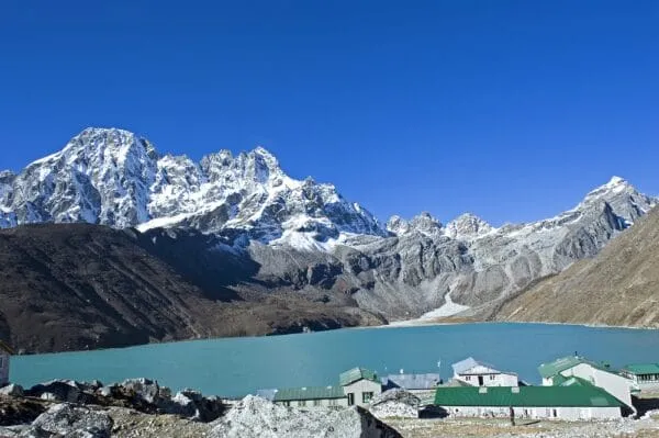
Sundarijal To Gosainkunda Lake Trek
Be a part of an unforgettable 11-day adventure in Nepal's most magnificent landscapes and cultural richness on the Sundarijal...
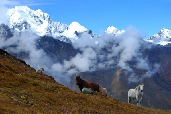
Tamang Heritage Trek
Tamang Heritage Trek is one interesting tour package that has combined some of the most breathtaking nature with the...
Langtang Kyanjin Gompa Trek
Langtang Kyanjin Gompa Trek is a trek into the memory lanes of lush valleys and towering peaks. Feel the...
Langtang Valley Trek
Langtang Valley Trek was once a part of the Langtang National Park. Otherwise known as the Tamang Heritage Trail,...

