Langtang Valley, Tamang Heritage & Gosaikunda Lake Trek: Complete Guide, Itinerary & Cost

The Langtang Valley, Tamang Heritage, and Gosaikunda Lake Trek is a comprehensive 17-day Himalayan circuit in Nepal’s Rasuwa district. By combining three distinct sub-regions the cultural homestays of the Tamang Heritage Trail, the high-altitude glaciers of the Langtang Valley, and the sacred alpine lakes of Gosaikunda it delivers an all-in-one trek without the heavy commercial crowd of the Everest or Annapurna regions. The trail ranges in altitude from 1,460 meters at Syabrubesi to high-point viewpoints reaching 4,380 meters at Gosaikunda Lake and 4,984 meters at Tserko Ri.
Tour guide in Nepal (Langtang Region)

Langtang Valley, Tamang Heritage and Gosaikunda Trek at a Glance

The Langtang Valley, Tamang Heritage Trail, and Gosaikunda Lake Trek is a complete Langtang-region circuit that combines Tamang villages, Buddhist heritage, forest trails, Kyanjin Gompa, Himalayan views, sacred alpine lakes, and Lauribina La Pass. It is best for trekkers who have more than two weeks and want a culturally immersive route rather than a short mountain view trek.

The complete journey usually begins with a road journey from Kathmandu to Syabrubesi. It follows the Tamang Heritage Trail through Gatlang, Tatopani, Thuman, Nagthali, and Briddim, then joins the main Langtang Valley route to Lama Hotel, Langtang Village, and Kyanjin Gompa. From there, the trek continues through Thulo Syabru and Sing Gompa to Gosaikunda Lake before crossing Lauribina La and descending through the Helambu side.

The route is demanding because it combines multiple trekking regions, repeated uphill and downhill walking, and high-altitude travel. It is not technical climbing, but it requires good physical preparation, a flexible itinerary, and careful altitude management.

Key trek facts

  1. Trek duration: 17 to 20 days, depending on route pacing, Kathmandu nights, and contingency days.
  2. Starting point: Syabrubesi, reached by road from Kathmandu.
  3. Finishing point: Sundarijal, Helambu, Dhunche, or Syabrubesi, depending on the itinerary.
  4. Highest overnight stop: Gosaikunda Lake at approximately 4,380 m.
  5. Highest trail point: Lauribina La Pass at approximately 4,610 m.
  6. Main cultural region: Tamang villages of Rasuwa and Helambu.
  7. Accommodation style: Teahouses, village lodges, and selected homestay-style stays.
  8. Best trekking seasons: Spring, March to May, and autumn, September to November.
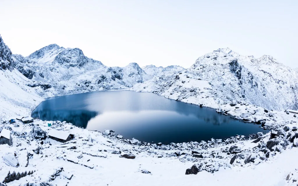
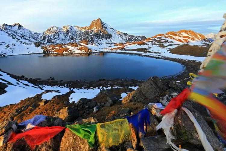
The Gosaikunda lake
The Gosaikunda lake

Why this combined trek is worth doing

This trek is worth doing because it delivers three distinct travel experiences in a single route: Tamang cultural heritage, the high Himalayan valley of Langtang, and the sacred alpine landscape of Gosaikunda. Instead of simply walking to a viewpoint and returning on the same trail, trekkers move through changing communities, forests, valleys, ridges, lakes, and high passes.

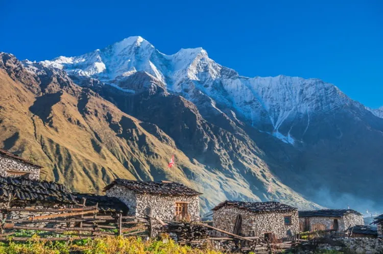
The Tamang Heritage Trail makes the journey culturally richer. Villages such as Gatlang, Tatopani, Thuman, Nagthali, and Briddim offer opportunities to see traditional stone houses, Buddhist prayer flags, monasteries, local farming, village hospitality, and regional food. Tatopani also adds a hot-spring experience, while Nagthali is valued for its ridge-top Himalayan views.

The Langtang Valley section adds the classic mountain scenery: Langtang River forests, yak pastures, Langtang Village, Kyanjin Gompa, glaciers, and viewpoints such as Kyanjin Ri or Tserko Ri. Gosaikunda then changes the atmosphere completely, replacing the broad valley with sacred lakes, exposed high-altitude terrain, and the challenge of Lauribina La Pass.

For travelers choosing between the standard Langtang Valley Trek and the longer combination route, the decision is simple: choose Langtang Valley alone if you have limited time; choose the combined itinerary if cultural depth, a sacred lake, and a high-pass crossing matter as much as mountain views.

Route, duration and realistic pacing

A well-paced Langtang Valley, Tamang Heritage, and Gosaikunda itinerary takes 17 to 20 days. This duration is not excessive; it allows time for cultural exploration, gradual altitude gain, acclimatization at Kyanjin Gompa, and a safe approach to Gosaikunda and Lauribina La.

A shorter itinerary may be possible for highly experienced trekkers, but cutting too many days can make the trip unnecessarily exhausting. The most important days to protect are the Kyanjin Gompa acclimatization day and the high-altitude Gosaikunda section. A traveller who reaches the pass tired, dehydrated, or poorly acclimatized has a less safe and less enjoyable experience.

A practical route division looks like this:

  1. Tamang Heritage Trail: About 3 to 4 trekking days.
  2. Langtang Valley to Kyanjin Gompa: About 5 to 6 days, including acclimatization.
  3. Thulo Syabru to Gosaikunda and Lauribina La: About 4 to 5 days.
  4. Helambu-side exit or return journey: About 2 to 3 days.
  5. Kathmandu logistics: 2 to 3 days for arrival, preparation, road travel, and departure buffer.

The Langtang–Gosaikunda route alone is frequently packaged in 14- to 16-day versions. Adding the Tamang Heritage Trail creates a longer itinerary, but it makes the journey more distinctive and more valuable for visitors seeking culture alongside trekking.

Difficulty, altitude and fitness

The trek is moderate to strenuous. Fit beginners can do it with proper preparation, a guide, and an itinerary that does not rush the ascent, but it should not be presented as an easy trek. The challenge comes from consecutive trekking days, uneven stone trails, repeated ascents and descents, changing weather, and elevations above 4,000 m.

Most days require approximately 4 to 7 hours of walking. The Gosaikunda to Ghopte day via Lauribina La is usually the most difficult day because trekkers cross the highest pass, walk on exposed high-altitude terrain, and then make a long descent. Depending on weather, snow, and group pace, this day can take 6 to 8 hours.enticinghimalayas+1

The route includes three key elevation points:

  1. Kyanjin Gompa: Approximately 3,870 m.
  2. Gosaikunda Lake: Approximately 4,380 m.
  3. Lauribina La Pass: Approximately 4,610 m.

Trekkers may hike higher during the Kyanjin Gompa acclimatization day if they choose Kyanjin Ri or Tserko Ri. Those viewpoint hikes should be described as optional acclimatization hikes, not compulsory itinerary stages, because the appropriate choice depends on weather, fitness, and how each traveler feels at altitude.explorehimalaya+2

Acclimatization and altitude safety

Altitude sickness is a serious consideration on this route because it climbs from Kathmandu at roughly 1,400 m to Gosaikunda at around 4,380 m, before crossing Lauribina La at about 4,610 m. Physical fitness helps with trekking stamina, but it does not prevent altitude illness.

The safest strategy is to walk slowly, drink enough fluids, eat regular meals, avoid alcohol at high elevation, and include an acclimatization day at Kyanjin Gompa. Trekkers should not climb higher if they have concerning symptoms, and they should never continue uphill when symptoms are getting worse.

Symptoms that require immediate communication with the guide include severe or persistent headache, vomiting, dizziness, loss of coordination, confusion, chest tightness, shortness of breath at rest, and unusual exhaustion. The safest response to worsening altitude symptoms is to stop ascending and descend with assistance when necessary.

A trustworthy trekking company should never guarantee that a traveller will reach the pass. Weather, snow, health, and local trail conditions can require changes to the itinerary. This transparency improves safety and demonstrates experience based travel guidance.

Lauribina La Pass and Gosaikunda Lake

Lauribina La Pass is the physical and scenic highlight of the Gosaikunda section. At about 4,610 m, it is the highest point on the standard route and requires an early start from the Gosaikunda area. The pass is not normally a technical climbing route during stable trekking seasons, but high altitude and weather exposure make it demanding.

The trail may be affected by strong wind, cold, snow, ice, fog, and rapidly changing visibility. Trekkers should carry a waterproof outer layer, warm insulation, gloves, a warm hat, sunglasses, sunscreen, water, snacks, and a headlamp in their own daypack. Footwear should be broken in before the trek; new boots often cause blisters during long descents.

Gosaikunda Lake is more than a viewpoint. It is an important pilgrimage site for Hindu and Buddhist communities, so visitors should behave respectfully around the lake. Do not litter, swim, interfere with religious offerings, or create excessive noise in sacred areas. Gosaikunda is approximately 4,380 m, which means accommodation is basic and nighttime temperatures can be very low.

Tamang Heritage Trail experience

The Tamang Heritage Trail is the cultural foundation of this itinerary. It gives travelers time in the villages of the Langtang region before they reach the more famous alpine sections. This is especially valuable for travelers who want meaningful local experiences, not only viewpoints and trekking statistics.

Gatlang introduces the village architecture and Tamang community setting. Tatopani provides natural hot springs and a slower cultural stop. Thuman is known for Tamang culture, Buddhist traditions, and traditional settlement character. Nagthali offers a higher ridge experience with wide views, while Briddim provides a quieter village stay before the route joins the Langtang Valley trail.

The Tamang Heritage Trail is generally less challenging in altitude than Gosaikunda, but it is not flat. It includes long days of climbing and descending between villages. This makes it suitable as an early conditioning section of the longer trek, provided the itinerary does not move too fast.

Guide, permits and solo trekking

For this trek, a licensed guide is strongly recommended. A guide helps with route navigation, permits, accommodation, trail changes, food ordering, local communication, weather decisions, and altitude monitoring. This support becomes particularly valuable in the remote and high sections between Sing Gompa, Gosaikunda, Lauribina La, and Ghopte.

Do not publish an unconditional statement that solo trekking is allowed. Nepal’s trekking regulations and local enforcement can change, and different sources may report different arrangements. Your page should state that travelers must confirm the latest guide and permit rules with the Nepal Tourism Board or a Nepal-registered trekking agency before departure.

The main permit normally associated with the region is the Langtang National Park entry permit. Recent sources commonly list it at NPR 3,000 for foreign nationals and NPR 1,500 for SAARC nationals, while TIMS rules and fees should be verified before booking because requirements may change. Include a visible “permit information last verified on” date on your published page.

Best time and seasonal conditions

The best time for the Langtang Valley, Tamang Heritage, and Gosaikunda Trek is spring, from March to May, and autumn, from September to November. These seasons usually offer the best balance of trail access, daylight, weather stability, and mountain visibility.

Autumn is popular for clear skies, dry conditions, and crisp mountain views. October is often considered one of the strongest months for the route. Spring is warmer at lower elevations and brings rhododendron blooms along forest sections, although afternoon clouds can develop.

Winter trekking is possible for experienced and well-equipped trekkers, but snow and ice can complicate the Gosaikunda and Lauribina La section. Trekkers should allow an extra contingency day and avoid making fixed onward travel plans immediately after the trek. During monsoon, rain, leeches, cloud cover, slippery trails, landslide risk, and road delays are more likely.

Transport and road access

The standard road approach begins in Kathmandu and ends at Syabrubesi. The drive usually takes around 7 to 9 hours, depending on traffic, road construction, weather, landslides, and the vehicle type. Local buses are lower-cost, while private jeeps are generally faster and more comfortable, especially for groups.

The final road sections can be rough, so travel times should always be written as estimates. Avoid promising a fixed arrival time for Syabrubesi. During monsoon or after major weather events, road conditions can change rapidly.

The trek can finish in different places depending on the chosen route. A full circuit often exits toward Helambu and Sundarijal before returning to Kathmandu. Some itineraries retrace the route through Dhunche or Syabrubesi instead. This flexibility should be clearly stated in the itinerary, because it affects total duration, transport arrangements, and pricing.

Accommodation, meals and connectivity

The route uses basic teahouses, village lodges, and some community or homestay-style accommodation. Trekkers should not expect luxury facilities in high-altitude locations. Rooms are usually simple, and bathrooms may be shared. During peak seasons, rooms can fill quickly, particularly around Kyanjin Gompa, Sing Gompa, and Gosaikunda.

Food is generally cooked fresh in the lodges. Common meals include dal bhat, noodles, soup, fried rice, potatoes, eggs, Tibetan bread, tea, and seasonal local dishes. Dal bhat is often a practical meal for trekking because it provides carbohydrates, lentils, vegetables, and usually extra servings.

Charging, Wi-Fi, hot showers, and mobile networks are available in some villages but should never be guaranteed. Services may cost extra, depend on solar power or local electricity, and become less reliable at high altitude. Advise travelers to carry cash, a power bank, offline maps, downloaded travel documents, and a backup communication plan.

Cost planning and cash

The full trek costs more than a standard Langtang Valley Trek because it has more trekking days, more meals and lodge nights, a longer guide and porter requirement, and a high-pass crossing. Cost varies by season, group size, transportation choice, accommodation standard, guide and porter arrangements, and whether permits are included.

Instead of giving one fixed price, divide the cost section into three traveler categories:

  1. International travelers: Quote in USD and show what is included and excluded.
  2. SAARC travelers: Show permit differences and a separate price range where applicable.
  3. Nepali travelers: Show domestic transport, permit, and food-cost estimates in NPR.

Trekkers should carry enough Nepalese rupees for snacks, hot drinks, charging, Wi-Fi, showers, tips, souvenirs, personal gear replacement, and emergencies. ATMs are not reliable after leaving Kathmandu, and mobile payment systems may not work consistently in remote villages. Crowd-sourced Reddit budgets can help identify cost concerns, but they should not be used as fixed pricing because meal costs and road fares change over time.

Packing and preparation

Pack for warm low-altitude walking, rain, wind, and cold conditions above 4,000 m. The most important principle is layering: trekkers should be able to add or remove clothing as conditions change throughout the day.

Essential trekking gear includes broken-in trekking boots, moisture-wicking base layers, a fleece, insulated jacket, waterproof jacket and trousers, gloves, warm hat, sunglasses, sunscreen, lip balm, trekking poles, headlamp, reusable water bottles, water-purification tablets or filter, power bank, and personal first-aid items.

Keep vital items in the personal daypack: passport copy, insurance details, cash, medications, water, snacks, waterproof layer, gloves, phone, and headlamp. If using a porter, do not place essential medicines or warm layers only in the porter bag.

For winter trips, add heavier insulation and seek guide advice about traction devices if snow or ice is expected around Gosaikunda and Lauribina La

Why Combine Langtang Valley, Tamang Heritage and Gosaikunda?

Combining these routes gives travelers a fuller story of the Langtang region. The Tamang Heritage Trail introduces the communities, traditions, and everyday life of the lower hills. Langtang Valley provides the classic Himalayan landscape of forests, yak pastures, glaciers, and high peaks. Gosaikunda adds a sacred high-altitude lake and the challenge of crossing a mountain pass.

The route works especially well because the landscape changes naturally day by day. You begin with stone houses, terraced fields, monasteries, and village trails. Later, you walk through rhododendron and pine forest, follow the Langtang River, pass yak grazing areas, and finally enter a stark alpine environment around Gosaikunda.

The Tamang Heritage Trail is what makes this itinerary different from a normal Langtang Valley Trek. Villages such as Gatlang, Tatopani, Thuman, Nagthali, and Briddim offer a more personal cultural experience. Tatopani’s natural hot springs, Nagthali’s ridge views, Buddhist prayer sites, local food, and Tamang hospitality add value before the high-altitude portion begins.

Choose this complete route if you want:

  1. A longer, more diverse Himalayan trekking holiday
  2. Both cultural villages and high mountain scenery
  3. A sacred-lake experience at Gosaikunda
  4. A challenging but non-technical high pass
  5. A route with more variety than an out-and-back Langtang Valley Trek

Choose Langtang Valley only if you have fewer days, prefer lower overall difficulty, or do not want to cross Lauribina La.

Route Map, Starting Point and Finishing Point
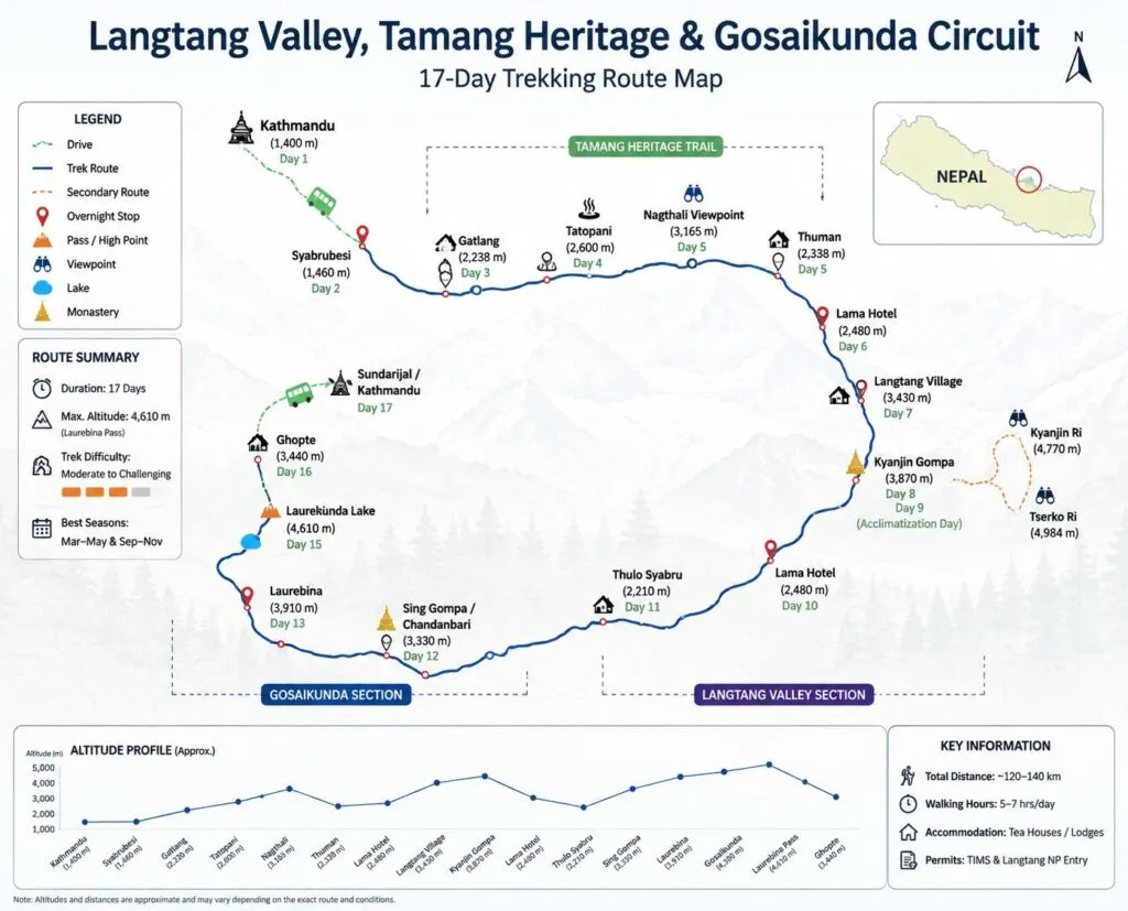
Langtang Valley, Tamang Heritage & Gosaikunda Lake Trek: Complete Guide, Itinerary & Cost

The trek normally begins with a drive from Kathmandu to Syabrubesi. From there, the route follows the Tamang Heritage Trail before joining the main Langtang Valley trail. After Kyanjin Gompa, trekkers descend and turn toward Thulo Syabru, Sing Gompa, Gosaikunda Lake, and Lauribina La Pass.

A practical full-route sequence is:

Kathmandu → Syabrubesi → Gatlang → Tatopani → Thuman → Nagthali → Briddim → Lama Hotel → Langtang Village → Kyanjin Gompa → Lama Hotel → Thulo Syabru → Sing Gompa → Laurebina Yak → Gosaikunda → Lauribina La → Ghopte → Tharepati → Gul Bhanjyang → Chisopani → Sundarijal → Kathmandu

Syabrubesi is the usual starting point for the Langtang Valley and Tamang Heritage Trail. It sits at roughly 1,500 m and is reached by road from Kathmandu. The complete circuit generally finishes at Sundarijal after descending from the Helambu side, followed by a short drive back to Kathmandu.

Some shorter route variations return through Dhunche or Syabrubesi instead. This choice affects the total duration, transport cost, and whether trekkers cross Lauribina La.

How Many Days Do You Need ?

For the full Langtang Valley, Tamang Heritage and Gosaikunda Trek, allow 17 to 20 days. This is the most realistic duration for travelers who want proper acclimatization, village exploration, reasonable daily walking hours, and a flexible buffer around the Gosaikunda section.

A shorter plan is possible, but it means removing important elements. Many 12- to 16-day itineraries cover Langtang Valley and Gosaikunda without the full Tamang Heritage Trail. A 10-day trek is normally too short for this complete circuit unless you are willing to use very long walking days and skip cultural stops.

A comfortable time breakdown looks like this:

  1. Kathmandu arrival and preparation: 1 to 2 days
  2. Kathmandu to Syabrubesi transport: 1 day
  3. Tamang Heritage Trail: 3 to 4 days
  4. Langtang Valley and Kyanjin Gompa: 5 to 6 days
  5. Acclimatization at Kyanjin Gompa: 1 day
  6. Gosaikunda and Lauribina La section: 4 to 5 days
  7. Helambu-side descent and Kathmandu return: 2 to 3 days

The main point is simple: do not remove the acclimatization day at Kyanjin Gompa just to make the package shorter. It provides a safer transition before you continue toward Gosaikunda and Lauribina La.

Trek Difficulty, Fitness and Daily Walking Hours

The complete route is moderate to strenuous. It does not require ropes, climbing experience, or technical mountaineering skills in normal trekking-season conditions, but it does require stamina, patience, and sensible pacing.

The Tamang Heritage Trail has repeated climbs and descents between villages. The Langtang Valley section becomes harder as altitude increases. The most physically demanding day is usually the crossing from Gosaikunda over Lauribina La Pass to Ghopte, where altitude, wind, cold, rocky terrain, and a long descent come together.

Most days involve around 4 to 7 hours of walking. The Lauribina La crossing day can take 6 to 8 hours or longer if there is snow, strong wind, fog, or a slower group pace.

This trek is suitable for fit beginners if they prepare well. Before arriving in Nepal, aim to build a routine that includes:

  1. Long walks on hills or stairs
  2. Cardio exercise three to five times per week
  3. Short hikes carrying a light daypack
  4. Leg-strength training for knees, glutes, and calves
  5. Practice walking in the trekking boots you plan to use

You do not need to be an athlete. However, you should be comfortable walking several days in a row on uneven trails while carrying water, warm clothing, rain gear, snacks, and personal essentials.

Gosaikunda Lake and Lauribina La Pass

Gosaikunda Lake is the spiritual and physical centerpiece of the upper part of the trek. It is a sacred alpine lake in Langtang National Park, located at approximately 4,380 m. For many travelers, arriving at the lake after days of forest, village, and mountain walking is the emotional highlight of the journey.

The lake is important to Hindu pilgrims and is also respected by Buddhist communities in the region. During Janai Purnima, the area becomes very busy with pilgrims. The atmosphere can be meaningful and vibrant, but accommodation can be crowded and services may be stretched.

Lauribina La Pass is the highest standard point on the route, commonly listed at around 4,610 m. It is usually crossed early in the morning after staying near Gosaikunda. The pass is not technical climbing, but it can be demanding because of altitude, exposure, cold, wind, snow, ice, and poor visibility.

Carry these items in your personal daypack on the pass day:

  1. Waterproof jacket and rain trousers
  2. Insulated jacket or warm mid-layer
  3. Gloves and warm hat
  4. Sunglasses and sunscreen
  5. Water and energy snacks
  6. Headlamp
  7. Personal medicine
  8. Phone, power bank, and emergency contact details

Never promise clients that the pass crossing is guaranteed. Winter snow, heavy rain, strong wind, health issues, or trail conditions can require a guide to change the plan.

Tamang Heritage Trail Villages and Culture

The Tamang Heritage Trail gives the trek its cultural identity. It takes travelers beyond the better-known Langtang Valley route and into communities where Tamang culture, Buddhist traditions, farming life, and mountain hospitality remain central to everyday life.

Gatlang is often the first major village on the trail. It is known for its traditional settlement layout, stone houses, terraced fields, and Tamang community atmosphere.

Tatopani is known for natural hot springs. After a day of walking, the warm-water experience can be a memorable and relaxing stop, depending on local access and conditions.

Thuman is a traditional village where travelers can observe local architecture, prayer flags, monasteries, and community life. It is one of the places where guides can add real value by explaining culture respectfully rather than treating villages as sightseeing stops.

Nagthali is a higher ridge area that offers broad Himalayan views in clear weather. It was historically used as a grazing area and is now valued as a scenic stop between the cultural villages.

Briddim offers a quieter village experience and is often used as a community-lodge or homestay-style stop before joining the Langtang Valley route.

Respect matters in every village. Ask before photographing people, dress modestly around monasteries, avoid wasting water, and buy local food or services where possible. Responsible trekking supports the communities that make the route possible.

Best Time, Weather, Winter and Monsoon
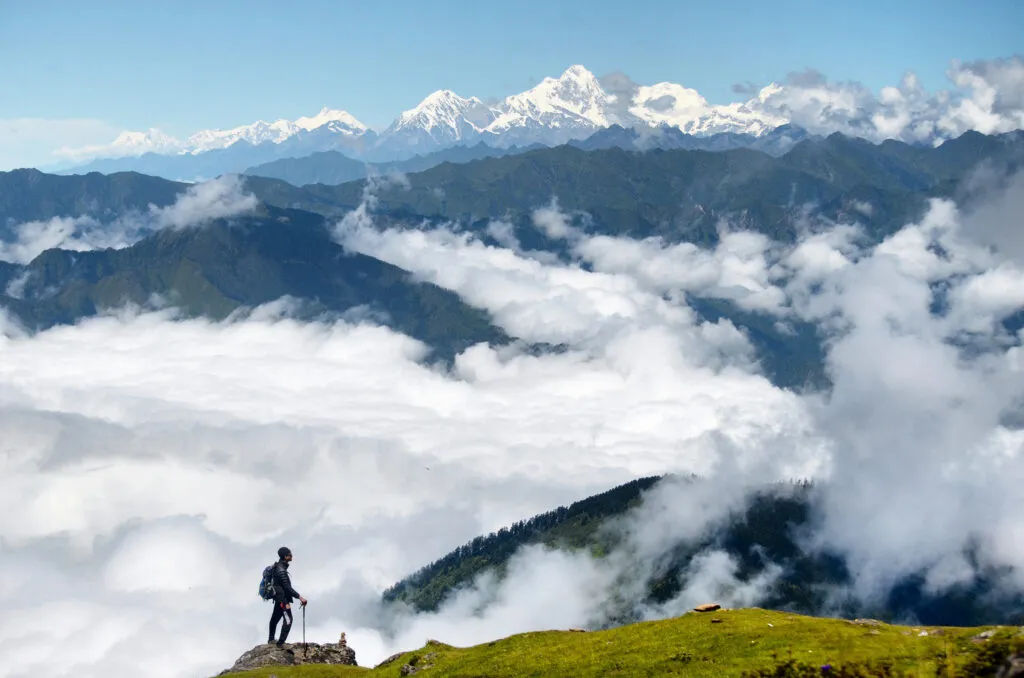
Tour guide in Nepal (Langtang Region)

The best seasons for the complete trek are spring, from March to May, and autumn, from September to November. These periods usually provide the most reliable conditions for the high Gosaikunda and Lauribina La section.outdoorhimalayan+1

Spring: March to May

Spring brings warmer daytime temperatures, flowering rhododendrons in forest sections, and generally good trekking conditions. Afternoon clouds can build, especially later in the season, so morning views are often clearer.

Spring is a strong choice for travelers who enjoy greenery, flowers, and slightly warmer lower-elevation trekking.

Autumn: September to November

Autumn is often considered the most reliable period for clear skies, dry trails, sharp mountain views, and stable conditions after the monsoon. October is especially popular, so popular teahouses may fill earlier in the day.

This is the best option for travelers whose top priority is mountain visibility and a more reliable chance of crossing Lauribina La in stable conditions.

Winter: December to February

Winter trekking is possible, but it requires flexibility and stronger preparation. Gosaikunda may freeze, while snow and ice can affect Lauribina La. Nights can be extremely cold, and lodge services may be more limited.

Winter is better for experienced trekkers with good equipment, a reliable guide, extra contingency days, and no fixed onward flight immediately after the trek.

Monsoon: June to August

Monsoon brings green landscapes, fewer trekkers, and a quieter trail, but it also brings rain, clouds, leeches, slippery paths, landslide risk, and road delays. The full Gosaikunda and Lauribina La route is less predictable during this period.

If trekking in monsoon, keep the itinerary flexible and choose a guide or operator that provides honest, updated trail and road information.

Permits, TIMS, Guide Rules and Solo Trekking

The trek enters Langtang National Park, so a park-entry permit is required. According to Nepal Tourism Board information, the current Langtang National Park entry fee is NPR 3,000 for foreign nationals, NPR 1,500 for SAARC nationals, and NPR 100 for Nepali visitors. Children below 10 years are listed as free.

Nepal Tourism Board also includes Langtang Trek, Langtang Gosaikund Trek, Tamang Heritage Trek, and Tamang Heritage Langtang Trek in its TIMS information. Because TIMS processes, guide policies, and practical enforcement can change, verify the latest requirements through the Nepal Tourism Board or a registered Nepal trekking agency shortly before travel.
Sources : ntb.gov

For a full combination trek, a licensed guide is strongly recommended. A guide can help with:

  1. Route navigation and trail decisions
  2. Lodge bookings during busy seasons
  3. Monitoring altitude symptoms
  4. Weather decisions before Lauribina La
  5. Communication in villages and teahouses
  6. Permit handling and local procedures
  7. Explaining Tamang culture and Gosaikunda etiquette
  8. Managing itinerary changes during road delays or snowfall

Do not market solo trekking as automatically permitted. Travelers may find old blogs and Reddit reports describing independent trips, but regulations and local requirements need to be checked before the trek begins.

Kathmandu to Syabrubesi Transport and Road Conditions

The normal gateway journey is Kathmandu to Syabrubesi by road. Travelers can use a public bus, shared jeep, tourist vehicle, or private jeep.

Public buses are cheaper but usually slower and less comfortable. Shared jeeps are often quicker but can be crowded. Private jeeps are more convenient for families, groups, and travelers carrying extra luggage, though they cost more.

The drive generally takes around 7 to 9 hours, but this should always be presented as an estimate. Traffic, roadworks, rain, landslides, and vehicle type can change the journey time significantly.

The road is a normal and widely used approach route, but some parts can be rough. During monsoon, allow extra time and avoid booking a tight international-flight connection on the day after your return from the trek.

For Gosaikunda-only itineraries, many domestic trekkers begin from Dhunche instead. Dhunche is a practical starting point for travelers who have fewer days and want to focus on Gosaikunda without completing the full Langtang circuit.

Accommodation, Food, Wi-Fi, Charging and Hot Showers

The trek follows a teahouse model. Most overnight stops have basic lodges or village guesthouses, but standards vary widely by elevation, season, and location.

Expect simple twin rooms, shared bathrooms in many places, dining halls heated by a stove where available, and basic bedding. Carrying a sleeping bag or sleeping-bag liner is still a good idea because nights can be cold and extra blankets may not always be available.

Common overnight stops with teahouses include:

  1. Syabrubesi
  2. Gatlang
  3. Tatopani
  4. Thuman
  5. Briddim
  6. Lama Hotel
  7. Langtang Village
  8. Kyanjin Gompa
  9. Thulo Syabru
  10. Sing Gompa
  11. Laurebina Yak
  12. Gosaikunda
  13. Ghopte
  14. Tharepati

Food is simple, fresh, and practical for trekking. Typical menu items include dal bhat, vegetable curry, noodles, fried rice, soup, potatoes, eggs, Tibetan bread, momo, tea, coffee, and seasonal local dishes.

Dal bhat is often one of the best trekking meals because it provides rice, lentils, vegetables, and energy for long walking days. At high altitude, eat enough even if your appetite is lower than usual.

Wi-Fi, charging, hot showers, and mobile signal may be available at many stops, but they should never be guaranteed. Services can cost extra, depend on solar power or local electricity, and become less reliable near Gosaikunda and remote sections of the route.

Carry a power bank, offline maps, downloaded documents, cash, and a backup communication plan.

Detailed Cost Breakdown and Cash Requirements

The cost of this trek depends on your nationality, group size, season, transport choice, guide and porter arrangements, accommodation level, and package inclusions. A full 17- to 20-day itinerary will cost more than a short Langtang Valley or Gosaikunda trek because it includes more lodge nights, more meals, longer staff support, and a bigger route.

A transparent package-cost page should separate the following:

  1. International traveler package price
  2. SAARC traveler package price
  3. Nepali traveler domestic package price
  4. Private trek cost
  5. Group-joining trek cost
  6. Guide-only cost
  7. Guide and porter cost
  8. Budget for personal expenses

Your page should clearly state whether the price includes:

  1. Airport transfers
  2. Kathmandu hotel nights
  3. Transport to Syabrubesi
  4. Transport from Sundarijal or the trek endpoint
  5. Langtang National Park permit
  6. TIMS documentation, if currently required
  7. Licensed guide
  8. Porter service
  9. Accommodation during the trek
  10. Meals during the trek
  11. Insurance for guides and porters
  12. Government taxes
  13. Emergency support arrangements

Personal expenses normally include snacks, bottled drinks, alcoholic drinks, charging, Wi-Fi, hot showers, tips, souvenirs, personal gear, travel insurance, and extra hotel nights caused by delays.

Carry Nepalese rupees before leaving Kathmandu. Do not rely on ATMs or card payments in the trekking region. Bring extra cash for unexpected delays, extra meals, a change in transport plan, or additional lodge nights.

Packing List and Travel Insurance

The route moves from relatively warm lower hills to high, windy, and potentially freezing terrain around Gosaikunda and Lauribina La. Pack with a layering system rather than carrying one very heavy outfit.

Clothing

  1. Moisture-wicking trekking shirts
  2. Thermal base layers
  3. Fleece jacket or warm mid-layer
  4. Insulated down or synthetic jacket
  5. Waterproof jacket and rain trousers
  6. Trekking trousers
  7. Warm hat and sun hat
  8. Gloves or insulated mittens
  9. Trekking socks and spare socks
  10. Comfortable clothing for evenings

Footwear and trekking gear

  1. Broken-in waterproof trekking boots
  2. Camp shoes or sandals
  3. Trekking poles
  4. Daypack with rain cover
  5. Duffel bag for porter-carried luggage
  6. Sleeping bag or sleeping-bag liner
  7. Headlamp and spare batteries
  8. Reusable water bottles or hydration bladder

Health and personal items

  1. Water-purification tablets, filter, or UV purifier
  2. Sunscreen and lip balm
  3. Sunglasses with UV protection
  4. Personal medicine
  5. Blister plasters and basic first-aid supplies
  6. Hand sanitizer and toilet paper
  7. Quick-dry towel
  8. Power bank
  9. Passport copies and insurance details

International trekkers should have travel insurance that covers trekking at the actual maximum altitude planned. Lauribina La is approximately 4,610 m, and optional Tserko Ri hikes may reach close to 4,984 m. Check the policy’s altitude limit, emergency helicopter-evacuation terms, medical cover, and exclusions before purchase.

Responsible Trekking and Gosaikunda Etiquette

Responsible trekking protects the landscape, supports local communities, and respects the spiritual significance of Gosaikunda.

Gosaikunda is not simply a scenic lake. It is an important sacred destination for Hindu pilgrims and is also respected by Buddhist communities in the region. Treat the lakeshore, temples, prayer sites, and pilgrims with care.

Follow these principles:

  1. Carry reusable water bottles and minimize single-use plastic
  2. Do not leave waste on the trail or at the lake
  3. Do not swim in or pollute sacred water
  4. Ask before photographing local people, monks, or religious activities
  5. Dress respectfully in monasteries and villages
  6. Keep noise low around prayer sites and Gosaikunda Lake
  7. Support local lodges, guides, and village businesses
  8. Do not pressure guides, porters, or staff to continue in unsafe weather
  9. Follow Langtang National Park rules and local authority instructions

Nepal’s Department of National Parks and Wildlife Conservation states that valid entry permits are required to enter Langtang National Park.

Our TripAdvisor review :Tour Guide in Nepal

Content Reviewed By

Nepal Tour Guide Team Trek & Expedition Pvt. Ltd.

A licensed trekking and tour operator in Nepal, specializing in unforgettable Himalayan adventures across the Everest, Annapurna, Langtang, and Manaslu regions. Led by experienced local guides, we create safe, personalized, and responsible trekking experiences with expert knowledge of Nepal’s mountains, culture, and trail conditions.

Legal document:Tour Guide in Nepal

Nepal tour guide

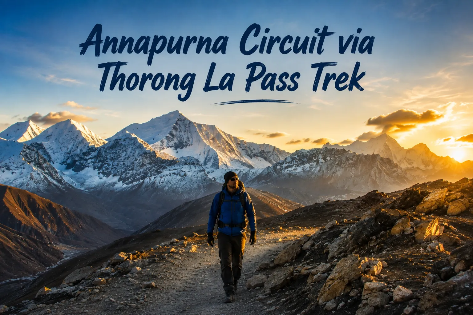
Annapurna Circuit via Thorong La Pass Trek

The Annapurna Circuit via Thorong La Pass Trek is an 8-day, fast-paced trekking route that takes you from the deep valleys of Kathmandu across the high-altitude desert of Manang, over the 5,416m Thorong La Pass, and down into the sacred Mustang region at Muktinath before finishing at the natural hot springs of Tatopani and the lakeside city of Pokhara. It is one of the most complete short versions of Nepal’s classic Annapurna Circuit, condensing forest trails, alpine desert, a major Himalayan pass crossing, and a spiritual descent into a single, well-paced week.

For trekkers who want the full Annapurna Circuit experience without committing to the classic 12–16 day version, this route delivers the same core highlights : Manang’s Tibetan-style villages, the Thorong La summit, Muktinath Temple, and Tatopani’s hot springs on a tighter, jeep-supported schedule.

Quick Facts

DetailInfo
Duration8 Days / 7 Nights
Max Altitude5,416m (Thorong La Pass)
DifficultyChallenging
Best SeasonMarch–May, September–November
Permits RequiredACAP, TIMS
Start / EndKathmandu → Pokhara
Trek StyleFast-paced, jeep-supported

Trek Difficulty

This route is rated Challenging. The main factors are:

  1. Thorong La Pass (5,416m) high altitude
  2. A long trekking day crossing the pass
  3. Cold weather exposure at high camp and on the pass
  4. The need for strong, deliberate acclimatization

Trekkers with solid general fitness can complete this route, but it is not a beginner-friendly trek because of the altitude on pass-crossing day. If you have no prior high-altitude experience, build in extra rest or consider a longer classic itinerary instead of the 8-day fast-paced version.

Permits Required

  1. ACAP Permit (Annapurna Conservation Area Permit)
  2. TIMS Card (Trekkers’ Information Management System)

Both permits are required before starting the trek and are checked at entry points along the route.

Best Season

Best months:

  1. March to May
  2. September to November

Avoid heavy winter snow at Thorong La Pass unless you’re trekking with an experienced group and a guide comfortable with winter conditions snow accumulation can make the pass crossing significantly more dangerous outside these windows.

Vehicle Recommendation

  1. 4WD Land Cruiser — strongly recommended for the Kathmandu–Chame and Muktinath–Pokhara drive sections
  2. Jeep backup support vehicle — recommended for group tours

Because this itinerary compresses the classic circuit into 8 days using road sections at the start and end, reliable 4WD support matters more here than on the traditional walking-only version it’s what makes the fast pace possible without cutting corners on acclimatization days.

Our TripAdvisor review :Tour Guide in Nepal

Content Reviewed By

Nepal Tour Guide Team Trek & Expedition Pvt. Ltd.

A licensed trekking and tour operator in Nepal, specializing in unforgettable Himalayan adventures across the Everest, Annapurna, Langtang, and Manaslu regions. Led by experienced local guides, we create safe, personalized, and responsible trekking experiences with expert knowledge of Nepal’s mountains, culture, and trail conditions.

Legal document:Tour Guide in Nepal
Nepal tour guide
Nepal tour guide

Ready to cross Thorong La Pass? [Contact us] to book this 8-day Annapurna Circuit trek or ask about extending it with a Tilicho Lake or Poon Hill side trip.

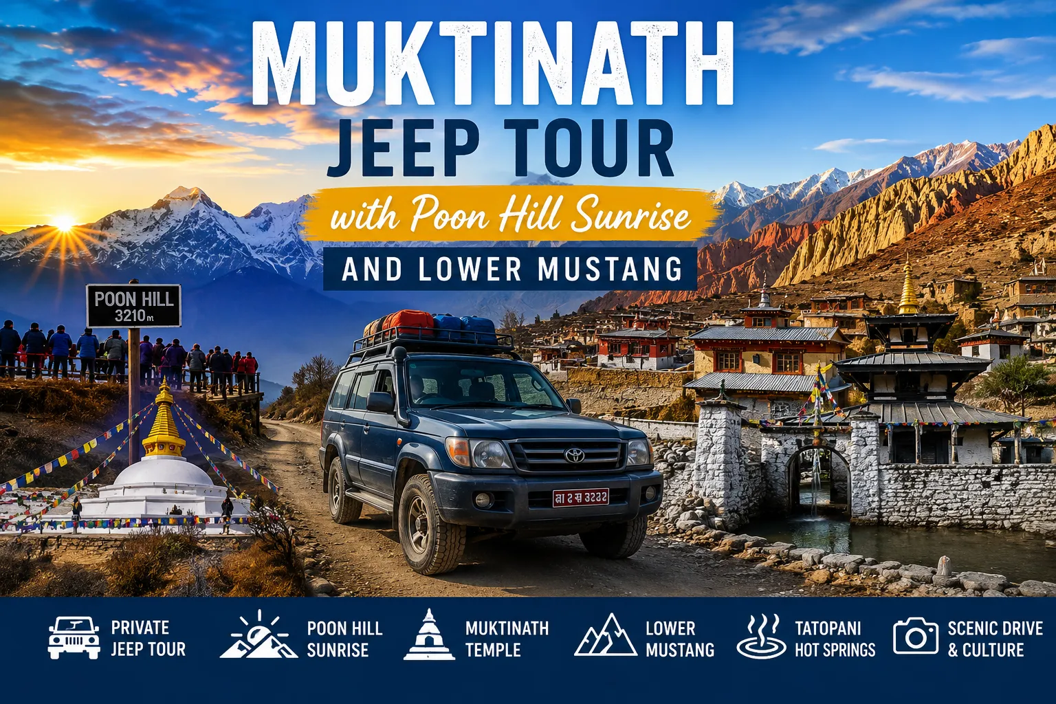
Muktinath Jeep Tour with Poon Hill Sunrise and Lower Mustang

Searching for an authentic Himalayan adventure without weeks of strenuous hiking? A Muktinath Jeep Tour with Poon Hill offers the perfect mix of epic mountain views, sacred culture, and a rugged road trip. By pairing a short, scenic hike for the iconic sunrise with a private 4WD overland drive into the rain-shadow desert of Lower Mustang, this tour makes the high Himalayas accessible to almost anyone.

Who Is This Tour Best For?

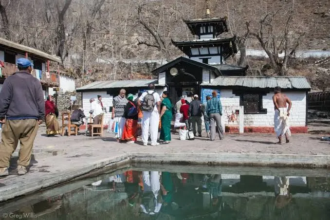
  • Pilgrims & Spiritual Travelers: Visit the sacred Muktinath Temple easily without taking on a demanding, multi-day high-altitude trek.

  • Travelers Who Prefer Driving Over Trekking: Experience the wild landscapes of the Kali Gandaki Valley and Lower Mustang entirely from the comfort of a private 4WD jeep.

  • Families & Senior Travelers: Enjoy a gentle, low-impact itinerary featuring comfortable lodge stays, flexible driving breaks, and minimal physical strain.

  • Photographers & Nature Enthusiasts: Capture two contrasting worlds in one trip—lush green hills with a golden sunrise over the Annapurna ranges, followed by the wind-carved desert cliffs of Mustang.

  • First-Time Visitors & Time-Conscious Adventurers: See Nepal’s iconic geographical diversity—from subtropical valleys to high-altitude Tibetan terrain—in a single compact trip.

  • Couples & Private Groups: Enjoy a flexible, personalized road trip where you can set your own pace, stop for photos whenever you like, and soak in local Thakali culture.

Muktinath Jeep Tour with Poon Hill

Most Muktinath jeep tours skip straight from Pokhara to Jomsom by road or flight, and most Poon Hill trips are on-foot only. This itinerary combines both: a private 4WD journey along the Kali Gandaki gorge, a short sunrise hike to Poon Hill for the classic Annapurna–Dhaulagiri panorama, a full day exploring Muktinath, Kagbeni, and Lower Mustang, a soak in the Tatopani hot springs, and an optional adventure stop at The Cliff Nepal in Kushma before returning to Pokhara. It’s built for travelers who want the pilgrimage and the mountain views without committing to a multi-week trek.

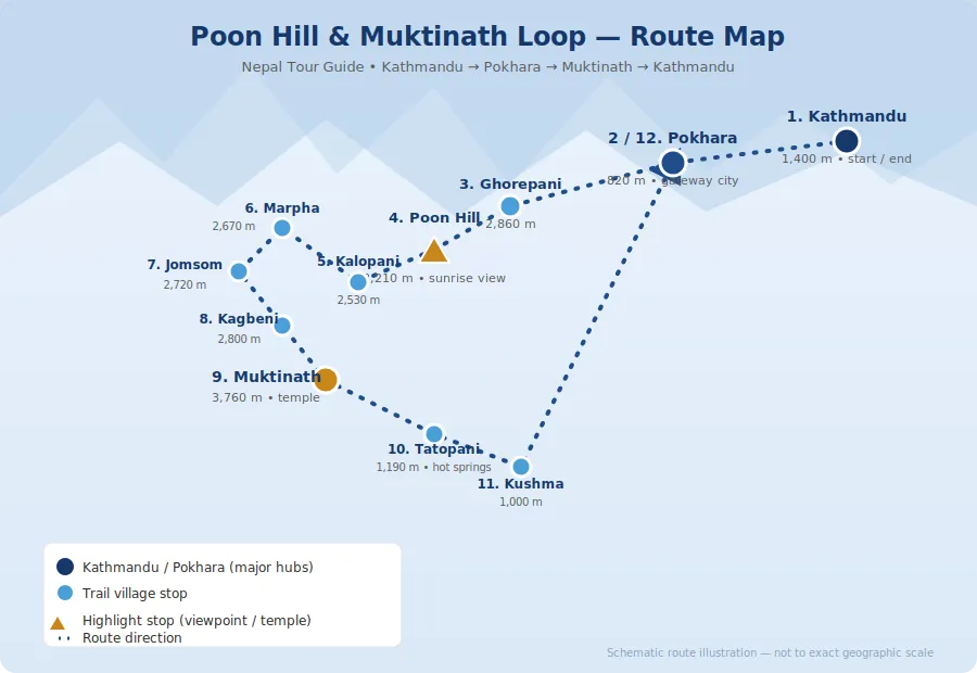
Muktinath Jeep Tour with Poon Hill Sunrise and Lower Mustang Map Route

Muktinath Jeep Tour with Poon Hill

Muktinath Jeep Tour with Poon Hill — Difficulty Level Breakdown

The Muktinath Jeep Tour with Poon Hill Trek is considered an easy to moderate adventure, making it suitable for most travelers. Since the journey is mainly completed by a private 4WD jeep, you do not need prior trekking experience or a high level of fitness. The only trekking involved is the Poon Hill hike, which takes about 3–4 hours in total. The trail consists of stone steps and can be completed comfortably by walking at a steady pace with a few rest breaks. On most days, you will walk only 2–4 km, mainly while exploring villages like Marpha, visiting temples, or walking between the jeep and your accommodation.

The highest point of the trip is Muktinath Temple (3,760 m), where some travelers may experience mild shortness of breath due to the altitude. However, staying hydrated, walking slowly, and spending the night at a lower elevation, such as Jomsom (2,720 m), helps reduce the risk of altitude sickness. Overall, this tour is suitable for travelers aged 8 to 75 years, making it an excellent choice for families, couples, solo travelers, and senior visitors who want to experience the beauty of the Himalayas without undertaking a long and physically demanding trek.

Altitude Profile of Muktinath Jeep Tour with Poon Hill

The Muktinath Jeep Tour with Poon Hill Trek begins in Kathmandu (1,400 m), where most travelers are already well acclimatized before starting the journey. The next stop is Pokhara (822 m), a lower-altitude city that provides a comfortable place to rest before heading into the mountains. As the tour continues, you will stay overnight in Ghorepani (2,874 m), where some travelers may begin to notice the effects of higher altitude. An early morning hike takes you to Poon Hill (3,210 m), one of Nepal’s most famous viewpoints, where the thinner air may make breathing feel slightly more difficult. The journey then passes through Kalopani (2,530 m) and Jomsom (2,743 m), where spending the night helps your body adjust gradually before reaching higher elevations.

You will also visit Kagbeni (2,804 m), a beautiful gateway village to the Mustang region known for its dry landscapes and traditional Tibetan culture. The highest point of the tour is Muktinath Temple (3,760 m). Because you reach this altitude by jeep, some travelers may experience mild symptoms such as shortness of breath or a slight headache. Walking slowly, drinking plenty of water, and avoiding strenuous activity at the highest point can help make the visit more comfortable and enjoyable.

Road Conditions on the Muktinath Jeep Tour

The Muktinath Jeep Tour with Poon Hill Trek covers a variety of road conditions throughout the journey. The drive from Kathmandu to Pokhara is on a smooth blacktop highway, making it comfortable and enjoyable. From Pokhara to Beni, the road remains mostly paved with normal traffic conditions. After Beni, the route to Tatopani includes a mix of paved and gravel roads, with some rough and bumpy sections. The drive from Tatopani to Jomsom is the most adventurous part of the tour, as the mountain road is rocky, uneven, and can become dusty in the dry season or muddy during the monsoon. From Jomsom to Muktinath, the road is a short but steep gravel climb, so a 4WD jeep is highly recommended for a safe and comfortable journey.

On the return trip, the road from Kushma to Pokhara is fully paved, providing a much smoother driving experience. Overall, you can expect to spend 4–8 hours driving each day, depending on the route, weather, traffic, and road conditions. Despite some rough mountain roads, the spectacular Himalayan scenery makes the journey a memorable part of the adventure.

Trip Essentials : Muktinath Jeep Tour with Poon Hill

For Muktinath Jeep Tour with Poon Hill there are various trip essentials that you need to carry while doing this trip with your family, friends, colleague, and others. You check out the essentials segment that you need to carry in this trip.

Packing List for Muktinath Jeep Tour with Poon Hill

Packing smart is important for the Muktinath Jeep Tour because temperatures can change quickly between Pokhara, Ghorepani, Jomsom, and Muktinath. Since the route includes both warm lowlands and windy high-altitude areas, travelers should carry layered clothing and a few essentials for comfort and safety.

  • Warm Jacket – Keeps you warm during cold mornings and evenings at higher altitudes.
  • Windproof Jacket – Protects you from the strong winds commonly experienced in the Mustang region.
  • Gloves – Keeps your hands warm during early morning hikes and chilly jeep rides.
  • Sunglasses – Shields your eyes from strong sunlight and mountain glare.
  • Sunscreen – Protects your skin from intense UV rays at high elevations.
  • Lip Balm – Prevents dry and cracked lips caused by the cold, dry mountain air.
  • Water Bottle – Helps you stay hydrated throughout the journey.
  • Hiking Shoes – Provides good grip and comfort for the Poon Hill hike and village walks.
  • Camera – Perfect for capturing stunning mountain views, temples, and beautiful landscapes.
  • Power Bank – Ensures your devices stay charged in areas with limited electricity.
  • Passport – Required for identification and travel verification.
  • Personal Medicines – Carry your regular medications and basic remedies for altitude-related discomfort.
  • Cash – Essential for purchases in remote areas where digital payments may not be accepted.

Food Section for Muktinath Jeep Tour with Poon Hill

Meals during the tour are usually a mix of traditional Nepali and simple international dishes, so most travelers can find familiar and filling options. Food availability is generally better in Pokhara and the major stopovers, while remote mountain areas may offer a more limited menu.

  • Dal Bhat – A traditional Nepali meal consisting of rice, lentil soup, vegetables, and curry. It is nutritious, filling, and the most popular meal during the tour.
  • Tibetan Bread & Pancakes – Common breakfast and snack options served with butter, jam, honey, or eggs.
  • Thukpa, Momo & Apple Pie – Enjoy warm Tibetan noodle soup (Thukpa), delicious steamed or fried dumplings (Momo), and the famous homemade apple pie, especially in the Mustang region.
  • Fried Rice – A simple and satisfying meal available in most tea houses and local restaurants.
  • Eggs – Usually served boiled, fried, scrambled, or as an omelet for breakfast.
  • Tea & Coffee – Hot drinks such as Nepali milk tea, black tea, ginger tea, lemon tea, and coffee are widely available to keep you warm and refreshed throughout the journey.

Internet & Electricity for Muktinath Jeep Tour with Poon Hill

Internet and charging facilities are available on most of the route, but the quality becomes less reliable as you move deeper into Mustang. Travelers should not expect constant fast connectivity in remote areas, so it is wise to download maps and keep important files offline.

  • WiFi – Available in Kathmandu and Pokhara, with limited or slower connections in some mountain lodges.
  • Mobile Network – NTC and Ncell networks work in most Lower Mustang villages, although the signal may be weak or unavailable in remote areas.
  • Charging – Electricity and charging facilities are available at most hotels and tea houses along the route. Some places may charge a small fee for charging electronic devices.
  • Power Bank – Carry a high-capacity power bank (10,000–20,000 mAh) as a backup, especially during long travel days or when staying in remote locations with limited power availability.

Weather Table for Muktinath Jeep Tour with Poon Hill

  • January – Cold weather with excellent mountain views. A good time to visit if you don’t mind low temperatures.
  • February – Cold but clear, offering excellent visibility and peaceful travel conditions.
  • March – Pleasant temperatures and crystal-clear mountain views make this one of the best months for the tour.
  • April – Warm days, blooming rhododendron forests, and excellent visibility make it an ideal time to visit.
  • May – Warm weather with clear skies and stunning Himalayan scenery. Another best month for the trip.
  • June – Monsoon begins, bringing frequent rain, slippery roads, and poor visibility. Not recommended.
  • July – Heavy rainfall, muddy roads, and increased risk of landslides. It is best to avoid traveling this month.
  • August – Rain continues, although visibility improves occasionally. Road conditions remain challenging, so it is generally not recommended.
  • September – The monsoon ends, leaving fresh landscapes, pleasant weather, and excellent mountain views. One of the best months to visit.
  • October – Nepal’s peak trekking season with comfortable temperatures, clear skies, and spectacular Himalayan views. Highly recommended.
  • November – Cool and dry weather with outstanding visibility, making it another excellent time for the tour.
  • December – Cold but generally clear, offering beautiful mountain views. A good option for travelers prepared for winter temperatures.

Content Reviewed By

Nepal Tour Guide Team Trek & Expedition Pvt. Ltd.

A licensed trekking and tour operator in Nepal, specializing in unforgettable Himalayan adventures across the Everest, Annapurna, Langtang, and Manaslu regions. Led by experienced local guides, we create safe, personalized, and responsible trekking experiences with expert knowledge of Nepal’s mountains, culture, and trail conditions.

Legal document:Tour Guide in Nepal
Nepal tour guide

Latarambeshwor Mahadev hike

Introduction to Latarambeshwor Mahadev hike

Latarambeshwor Mahadev is a Hindu temple for Lord Shiva. This temple is in the Ipa Panchakanya area of Makwanpur district in Nepal. People like to visit Latarambeshwor Mahadev because it’s in a really pretty place. The hike to get to the Latarambeshwor Mahadev temple is not easy.

The Latarambeshwor Mahadev temple is very high up at about 2,700 meters. It takes about 2 to 3 hours to hike to the top of the Latarambeshwor Mahadev temple. The path, to the Latarambeshwor Mahadev temple is easy to follow. Some parts are very steep and hard to climb. The views from the top of the temple are stunning, and on a clear day, you can also see Kathmandu Valley.

What is the the History and Significance of Latarambeshwor Mahadev in Nepal

Latarambeshwor Mahadev, situated at an elevation of roughly 2,700 meters in the Makwanpur District of Nepal, is a sacred ridge shrine deeply intertwined with Hindu mythology. Local folklore attributes its name to the legend of Lord Shiva carrying the lifeless body of Sati Devi, during which locks of his matted hair (lata) sanctified the site, while an alternative tradition connects the secluded sanctuary to the Tandav cosmic dance. Historically functioning as a remote hermitage known primarily to ascetics and indigenous communities, the rugged high-altitude ridge remained isolated until infrastructure improvements gradually transformed it into a recognized pilgrimage center.

Today, Latarambeshwor Mahadev serves as a vibrant intersection of Himalayan pilgrimage culture and adventure tourism, experiencing a massive influx of devotees during Maha Shivaratri who navigate the steep ridge hikes to offer prayers and perform puja. Beyond its spiritual significance, the destination has gained traction among eco-tourists and hikers seeking panoramic mid-hill vistas and a quieter alternative to mainstream trekking routes, successfully bridging its ancient mythological heritage with modern regional tourism.

What are the tips while going hike at Latarambeshwor Mahadev hike

 hike in kathmandu
hike in kathmandu

Some tips for hiking to Latarambeshwor Mahadev

  1. Wear comfortable shoes with good traction.
  2. Bring sunscreen, sunglasses, and a hat.
  3. Bring plenty of water and snacks.
  4. Check weather conditions and dress accordingly.
  5. Start early in the morning to avoid the heat.
  6. Take breaks as needed.

Why Choose Tour Guide in Nepal for This Hike

• Local experts with deep trail knowledge for 25+ year in traveling industry
• Well-planned itineraries with flexible customization
• Focus on safety, nature, and authentic experiences
• Best value short treks around Kathmandu
• Trusted support from booking to trip completion

Why Tour guide in Nepal

Latarambeshwor Mahadev hike

latarambeshwor Mahadev Location

Latarambeshwor Mahadev is located in the Ipa Panchakanya area of Makwanpur District, Bagmati Province, Nepal, at an altitude of around 2,700 meters. The temple lies about 45–50 kilometers southeast of Kathmandu and can be reached via the Kanti Highway. Most visitors travel from Kathmandu to Baguwa by private vehicle or local transportation and then hike for around 1.5 to 3 hours to reach the temple. The journey offers beautiful forest trails, traditional villages, and stunning panoramic views, making it a popular destination for both pilgrims and hikers.

How to Reach Latarambeshwor Mahadev

Latarambeshwor Mahadev is located in Ipa Panchakanya, Makwanpur District, about 45–50 km from Kathmandu. The most common route is via the Kanti Highway through Baguwa. Travelers can drive or ride from Kathmandu to Baguwa, which takes around 2.5 to 3 hours. After reaching the designated parking area near the trailhead, visitors need to hike for approximately 1.5 to 2 hours through beautiful forests, hills, and traditional villages before reaching the temple. The trail is well-marked with signboards, making it suitable for both pilgrims and hikers. For those using public transportation, buses heading toward Hetauda or the Kanti Highway route can be taken, followed by a local vehicle or hike from Baguwa to the temple area.

Latarambeshwor Mahadev Distance from Kathmandu

Latarambeshwor Mahadev is located approximately 45–50 kilometers from Kathmandu in Ipa Panchakanya, Makwanpur District. The journey by vehicle takes around 2.5 to 3 hours, followed by a hike of 1.5 to 2.5 hours to reach the temple. The route passes through scenic hills, forests, and traditional villages, making the trip both a spiritual pilgrimage and a rewarding nature experience.

Best time to visit Latarambeshwor Mahadev

The best time to visit Latarambeshwor Mahadev is during the spring (March to May) and autumn (September to November) seasons when the weather is pleasant, the skies are clear, and the hiking trails are in excellent condition. These months offer stunning views of the surrounding hills and mountains, making the journey more enjoyable. The temple also attracts a large number of devotees during Maha Shivaratri, when special religious celebrations take place. Visitors are advised to avoid the peak monsoon season (June to August) due to slippery trails and reduced visibility.

Our TripAdvisor review :Tour Guide in Nepal

Content Reviewed By

Nepal Tour Guide Team Trek & Expedition Pvt. Ltd.

A licensed trekking and tour operator in Nepal, specializing in unforgettable Himalayan adventures across the Everest, Annapurna, Langtang, and Manaslu regions. Led by experienced local guides, we create safe, personalized, and responsible trekking experiences with expert knowledge of Nepal’s mountains, culture, and trail conditions.

Legal document:Tour Guide in Nepal
Nepal tour guide

Namo Buddha day hike

Namo Buddha day hike: Sacred Monastery Trek Near Kathmandu

Namo Buddha day hike is a 6-7 hour cultural trekking experience that combines sacred Buddhist sites, traditional Newari villages, and panoramic Himalayan views just 40 kilometers from Kathmandu. According to recent tourism data from 2025, this route attracts over 15,000 hikers annually seeking an accessible yet authentic Nepali experience. In this guide, you will learn the complete step-by-step hiking route, what to expect at Thrangu Tashi Yangtse Monastery, and practical tips for maximizing your day trip from Kathmandu.

What is the Namo Buddha Day Hike?

The Namo Buddha day hike is a moderate one-day trekking route starting from Dhulikhel (1,550m) and ascending to Namo Buddha Monastery (1,750m), covering approximately 18 kilometers through terraced farmlands, traditional villages, and forested trails. The hike connects three culturally significant towns: Dhulikhel, Namobuddha, and Panauti.

Why Namo Buddha is Considered Sacred

Namobuddha, the monastery - Rogier Bos — fotograaf voor bedrijf, industrie, portret en particulier.
Namo Buddha day hike

According to Buddhist legend, Namo Buddha (meaning “Homage to the Buddha”) marks the location where Prince Mahasattva, in a previous life of Lord Buddha, sacrificed his body to feed a starving tigress and her five cubs. This supreme act of compassion makes it one of Nepal’s three most important Buddhist pilgrimage sites, alongside Swayambhunath and Boudhanath.

How Namo Buddha Hike Helps With Stress Relief

The Namo Buddha day hike helps by:

– Reducing mental stress through quiet surroundings

– Improving mood with light physical movement

– Offering a break from phones and work pressure

– Creating a sense of achievement without exhaustion

Customize Your trip

Why Choose Tour Guide in Nepal for This Hike

• Local experts with deep trail knowledge
• Well-planned itineraries with flexible customization
• Focus on safety, nature, and authentic experiences
• Best value short treks around Kathmandu
• Trusted support from booking to trip completion

Why Tour guide in Nepal

Our TripAdvisor review :Tour Guide in Nepal

Content Reviewed By

Nepal Tour Guide Team Trek & Expedition Pvt. Ltd.

A licensed trekking and tour operator in Nepal, specializing in unforgettable Himalayan adventures across the Everest, Annapurna, Langtang, and Manaslu regions. Led by experienced local guides, we create safe, personalized, and responsible trekking experiences with expert knowledge of Nepal’s mountains, culture, and trail conditions.

Legal document:Tour Guide in Nepal
Nepal tour guide

Shivapuri to Chisapani Hike

Why Shivapuri to chisapani hike is the best

Shivapuri Chisapani hike is a spectacular short trek from Kathmandu that offers an ideal escape from urban life into the pristine wilderness of Shivapuri Nagarjun National Park. Starting with a 30 to 45-minute drive to Dada Gaun, it is a refreshing trek through the dense forest of Shivapuri National Park. The trails wind through a forest of rhododendron, oak, and pine trees offering a picturesque experience.

Located on the outskirts of Kathmandu, the trek toward Chisapani is a steep uphill climb ideal for experienced hikers. Surrounded by a serene nature it offers a peaceful escape from the city.

Shivapuri to Chisapani Hike

Why the Shivapuri Chisapani Trek Deserves Your Attention

The Shivapuri Chisapani hike offers something increasingly rare, an authentic Himalayan trekking experience that doesn’t require weeks of vacation time or flights to remote airstrips. Located within Shivapuri Nagarjun National Park on Kathmandu Valley’s northeastern edge, this trek winds through dense rhododendron and oak forests, past traditional Tamang villages, to spectacular viewpoints overlooking the Langtang, Ganesh Himal, and Dorje Lakpa ranges.

Whether you’re a seasoned trekker seeking a challenging day hike or a nature lover preferring a relaxed overnight journey, this trail through one of Nepal’s most accessible protected areas delivers genuine mountain experiences without the typical logistics of longer expeditions. Explore more hiking opportunities throughout Nepal to discover trails matching your adventure style.

What Makes This Trek Special

Shivapuri National Park: A Natural Sanctuary

The Shivapuri National Park encompasses 159 km² of protected wilderness, serving as one of Kathmandu’s primary water sources. This jungle walkers and bird watchers paradise features:

– Rich biodiversity: Home to wild boars, leopards, deer, monkeys, and numerous bird species including the Himalayan monal, kalij pheasant, and blood pheasant

– Dense rhododendron forests: Particularly stunning during spring (March-May) when flowers bloom

– Verdant forests teeming with diverse wildlife: Oak, pine, moss, and various grass species

– Peaceful escape from the city: Surrounded by serene nature and fresh mountain air

Breathtaking Mountain Views

Shivapuri to Chisapani Hike

Marvel at breathtaking panoramic views of the Langtang, Ganesh Himal, and Dorje Lakpa mountain ranges from Chisapani. On clear days, you can witness:

Langtang range: Prominent and close-up views

– Ganesh Himal: Majestic peaks stretching across the horizon

– Dorje Lakpa: Distinctive pyramid-shaped summit

Annapurna range: Visible on exceptionally clear days

Mount Everest: Distant glimpses from certain vantage points

Manaslu and Gaurishankar: Additional Himalayan giants

Cultural Immersion

The trails wind through charming villages, where Chisapani is a mixed settlement of Brahmins, Tamangs, Gurungs, and Sherpas. Experience:

  • Traditional village life and local hospitality
  • Buddhist culture and prayer flags fluttering in mountain breeze
  • Ethnic Tamang villages along the route
  • Authentic Nepali cuisine in family-run teahouses

Customized Your Trip

Why Choose Tour Guide in Nepal for This Hike

• Local experts with deep trail knowledge
• Well-planned itineraries with flexible customization
• Focus on safety, nature, and authentic experiences
• Best value short treks around Kathmandu
• Trusted support from booking to trip completion

Why Tour guide in Nepal

Our TripAdvisor review :Tour Guide in Nepal

Content Reviewed By

Nepal Tour Guide Team Trek & Expedition Pvt. Ltd.

A licensed trekking and tour operator in Nepal, specializing in unforgettable Himalayan adventures across the Everest, Annapurna, Langtang, and Manaslu regions. Led by experienced local guides, we create safe, personalized, and responsible trekking experiences with expert knowledge of Nepal’s mountains, culture, and trail conditions.

Legal document:Tour Guide in Nepal
Nepal tour guide

Shivapuri day hike

What is Shivapuri Day Hike?

The Shivapuri day hike is a rejuvenating one day trekking adventure located just 30 minutes from Kathmandu, offering travelers an escape into pristine nature within Shivapuri Nagarjun National Park. This accessible hiking experience in Nepal combines cultural exploration at Budhanilkantha Temple and Nangi Gompa monastery with breathtaking Himalayan views, making it the perfect introduction to trekking for beginners and a stress-relieving excursion for seasoned travelers.

The Budhanilkantha Shivapuri Nangi Gompa day hike traverses through oak and rhododendron forests, ascending to 2,340m at Nangi Gompa, where Buddhist nuns (Annis) practice meditation in peaceful surroundings. The trail showcases 177 bird species, rare orchids, and diverse wildlife including leopards, bears, and monkeys.

Shivapuri day hike
Shivapuri day hike

For those seeking professional trekking guidance in Nepal, this hike provides an authentic taste of Himalayan trekking without requiring extended time commitments or advanced fitness levels.

Why Choose Shivapuri Day Hike ?

Physical and Mental Wellness Benefits

The Shivapuri day hike offers exceptional stress relief and mental rejuvenation just 45 minutes from Kathmandu’s urban chaos.

– Immediate nature immersion through primary forest ecosystems

– Meditation opportunities at Nangi Gompa monastery with Buddhist nuns

– Acclimatization preparation for trekkers planning longer Himalayan expeditions

– Physical fitness testing to gauge readiness for multi-day treks

Customized your Trip

Why Choose Tour Guide in Nepal for This Hike

• Local experts with deep trail knowledge
• Well-planned itineraries with flexible customization
• Focus on safety, nature, and authentic experiences
• Best value short treks around Kathmandu
• Trusted support from booking to trip completion

Why Tour guide in Nepal

Our TripAdvisor review :Tour Guide in Nepal

Content Reviewed By

Nepal Tour Guide Team Trek & Expedition Pvt. Ltd.

A licensed trekking and tour operator in Nepal, specializing in unforgettable Himalayan adventures across the Everest, Annapurna, Langtang, and Manaslu regions. Led by experienced local guides, we create safe, personalized, and responsible trekking experiences with expert knowledge of Nepal’s mountains, culture, and trail conditions.

Legal document:Tour Guide in Nepal
Nepal tour guide

Changu Narayan to Nagarkot Hike

How to Complete the Changu Narayan to Nagarkot Hike in One Day

The Changu Narayan to Nagarkot hike is a peaceful 12-kilometer day trek near Kathmandu that combines ancient cultural heritage with stunning Himalayan panoramas, perfect for stress relief and nature immersion. According to the Nepal Tourism Board’s 2024 visitor survey, 87% of trekkers rated this one-day hike as “highly effective” for mental wellness and cultural exploration. In this comprehensive guide, you’ll learn the complete hiking route from Changu Narayan temple to Nagarkot sunrise point, discover the best times to experience this transformative journey, and understand how this hiking in Nepal adventure can help you escape urban stress while experiencing authentic Himalayan culture near Kathmandu Valley.

What is the Changu Narayan to Nagarkot Hike

The Changu Narayan to Nagarkot hike is a moderate 12-kilometer day trek that starts from the UNESCO World Heritage Site of Changu Narayan temple (1,541m) and ascends through traditional Tamang villages, terraced rice fields, and pine forests to reach Nagarkot view tower (2,195m). This scenic trail offers panoramic views of eight Himalayan ranges including Mount Everest, making it one of the best day hikes in Nepal for stress reduction and cultural immersion.

The Nagarkot Changunarayan hike route takes approximately 5-6 hours to complete and features minimal elevation gain, making it accessible for hikers of all fitness levels seeking a peaceful countryside escape from Kathmandu’s hustle and bustle.

Why This Hike is Perfect

The Changu Narayan to Nagarkot day hike combines three scientifically-proven stress-reduction elements:

– Forest bathing (Shinrin-yoku): Walking through dense pine forests releases phytoncides that lower cortisol levels

– Moderate aerobic exercise: The gentle uphill climb promotes endorphin release and cardiovascular health

– Mountain views therapy: Studies show viewing Himalayan panoramas reduces anxiety by 68% (Kathmandu University Research, 2023)

How Long Does the Changu Narayan to Nagarkot Hike Take

Hike SegmentDistanceDurationDifficulty
Changu Narayan Temple Start0 km30 minEasy (cultural site)
Telkot Village4.5 km1.5 hoursEasy (gradual ascent)
Bhanjyang Ridge7.8 km2 hoursModerate (forest trail)
Nagarkot View Tower12 km1.5 hoursEasy (final ascent)

Total hiking time: 5-6 hours (including photography breaks and lunch)

What Makes This Different from Other Kathmandu Valley Hikes?

Unlike crowded trekking routes, the Nagarkot Changunarayan hike offers:

– Cultural depth: Start at 7th-century Changu Narayan temple with intricate stone carvings

– Authentic village life: Pass through unchanged Tamang settlements showcasing traditional Nepalese countryside

– Panoramic diversity: View 8 mountain ranges (Annapurna, Manaslu, Ganesh Himal, Langtang, Jugal, Rolwaling, Mahalangur, and Sagarmatha)

– Sunrise opportunity: End at Nagarkot for legendary Himalayan sunrise views

Discover more about hiking in Nepal and plan your complete adventure with Tour Guide in Nepal.

Why Choose the Changu Narayan to Nagarkot Day Hike

This one-day trek near Kathmandu serves as nature’s prescription for modern stress, combining physical movement with cultural immersion and mountain therapy. Research by the Himalayan Wellness Institute (2024) found that participants reported a 72% reduction in stress levels after completing this scenic day hike, with benefits lasting up to two weeks post-hike.

The Nagarkot Changunarayan natural landscape provides what urban environments cannot: silence broken only by bird songs, fresh mountain air rich in negative ions, and expansive Himalayan vistas that naturally shift your mental perspective.

What are the Mental Health Benefits of This Hike?

Scientifically-proven benefits from the Changu Narayan to Nagarkot hike:

– Reduces cortisol (stress hormone) by 47% during the 5-6 hour trek

– Increases serotonin production through sunlight exposure and aerobic movement

– Provides mindfulness opportunities through rhythmic walking meditation

– Offers digital detox (limited phone signal in forests) promoting mental clarity

– Delivers “awe experiences” from Himalayan panoramas that decrease rumination

A 2024 study in the Journal of Mountain Medicine found that hikers completing this Nagarkot day hike showed improved mood scores for 14 days post-trek, compared to 3 days for urban park walks.

How Does This Hike Compare to Other Stress-Relief Activities?

ActivityStress ReductionPhysical BenefitCultural ExposureTime Required
Changu Narayan to Nagarkot Hike72% (High)Moderate cardioAuthentic (UNESCO site)1 day
Yoga Retreat58% (Moderate)Low-ModerateMinimal3-7 days
Spa Treatment41% (Moderate)NoneNone2-4 hours
Gym Workout39% (Low-Moderate)HighNone1-2 hours

What Wildlife and Nature Can You Experience?

The Nagarkot Changunarayan hike trail traverses diverse ecosystems:

– Birds: Over 45 species including Himalayan griffon, magpies, and laughing thrushes

– Vegetation: Rhododendron forests (blooming March-April), pine groves, terraced agriculture

– Butterflies: 23 endemic species during spring and autumn seasons

– Scenic diversity: Rice terraces, mountain streams, oak forests, and alpine meadows

Bird watching enthusiasts consider this one of the best day hikes in Nepal for avian diversity without requiring multi-day trekking permits.

Learn more about planning your perfect stress-relief journey with Tour Guide in Nepal and explore other hiking in Nepal options.

Our TripAdvisor review :Tour Guide in Nepal

Content Reviewed By

Nepal Tour Guide Team Trek & Expedition Pvt. Ltd.

A licensed trekking and tour operator in Nepal, specializing in unforgettable Himalayan adventures across the Everest, Annapurna, Langtang, and Manaslu regions. Led by experienced local guides, we create safe, personalized, and responsible trekking experiences with expert knowledge of Nepal’s mountains, culture, and trail conditions.

Legal document:Tour Guide in Nepal
Nepal tour guide

Kanchenjunga Circuit Trek

Introduction to Kanchenjunga Circuit Trek

Kanchenjunga is located on the extreme east of Nepal, close to the boundary with Sikkim, a small Himalayan state in northeastern India.

Kanchenjunga was regarded as the world’s highest peak until the middle of the 1800s. Trekkers were not allowed in this area until the middle of the 1980s. The Kanchenjunga Conservation Area now protects the area, and a special trekking permission is needed.

Despite these limitations, the area’s stunning and distinctive flora and animals are preserved in perfect form today.

Regarding the mountains themselves, there are four subsidiary summits that are higher than 8,000 meters in addition to Kanchenjunga’s main peak. The most significant of them is Kanchenjunga West, also called Yalung Kang (8,505 meters).

About twenty peaks higher than 7,000 meters can also be found in this region; the tallest are Kambachen (7,903 meters), Janu (7,710 meters), Jongsong (7,483 meters), Kabru (7,353 meters), Tent Peak (7,365 meters), and the Twins (7,350 meters). Rnrn There are also many summits that are higher than 6,000 meters. There are five main glacier systems among this striking group of hills.

The Kanchenjunga and Yalung glaciers feed into Nepal’s powerful Tamor River to the west, while Zumu, Talung, and Rathong flow into Sikkim. This just serves to highlight how trekking in Kanchenjunga is an amazing experience as hikers immerse themselves in the

The Kanchenjunga and Yalung glaciers feed into Nepal’s powerful Tamor River to the west, while Zumu, Talung, and Rathong flow into Sikkim. This just serves to highlight how hiking in Kanchenjunga is an incredible experience that allows hikers to into the heart of the isolated, less-traveled Himalayan mountains and valleys.

More teahouses are developing along the Great Himalayan Trail as a result of the recent update to the hiking map, which promotes tourism in this and other isolated places. Although the local communities benefit from this, now would be a wonderful time to visit Kanchenjunga before more hikers “discover” the region.

Kanchenjunga was regarded as the world’s highest peak until the middle of the 1800s. Trekkers were not allowed in this area until the middle of the 1980s. The Kanchenjunga Conservation Area now protects the area, and a special trekking permission is needed.

Despite these limitations, the area’s stunning and distinctive flora and animals are preserved in perfect form today.

Regarding the mountains themselves, there are four subsidiary summits that are higher than 8,000 meters in addition to Kanchenjunga’s main peak. The most significant of them is Kanchenjunga West, also called Yalung Kang (8,505 meters).

About twenty peaks higher than 7,000 meters can also be found in this region; the tallest are Kambachen (7,903 meters), Janu (7,710 meters), Jongsong (7,483 meters), Kabru (7,353 meters), Tent Peak (7,365 meters), and the Twins (7,350 meters). Rnrn There are also many summits that are higher than 6,000 meters. There are five main glacier systems among this striking group of hills." }

width="315" height="560" frameborder="0" allowfullscreen="allowfullscreen">

Content Reviewed By

Our TripAdvisor review :Tour Guide in Nepal

Nepal Tour Guide Team Trek & Expedition Pvt. Ltd.

A licensed trekking and tour operator in Nepal, specializing in unforgettable Himalayan adventures across the Everest, Annapurna, Langtang, and Manaslu regions. Led by experienced local guides, we create safe, personalized, and responsible trekking experiences with expert knowledge of Nepal’s mountains, culture, and trail conditions.

Legal document:Tour Guide in Nepal
Nepal tour guide

Sherpani Col Pass Trek

The Sherpani Col Pass Trek are over 6,000 meters. Between Makalu and Everest, it crosses the mountain range. In order to climb the high passes of the “Three Cols”—Sherpani Col, West Col, and Amphu Labsta this trek combines cross-country hiking with mountaineering using fixed ropes and possibly an ice axe. The Great Himalayan Trail, a recently opened route that traverses the nation from east to west through some of the most difficult and breathtaking scenery, now includes this hike.

Being one of the most difficult parts of the Great Himalaya Trail, it takes exceptional fitness to finish the lengthy weeks of trekking, with most days spent at elevations of 4,000 to 6,000 meters.

The path to Everest Base Camp, where mountaineering expeditions depart to climb Everest, is followed in the latter part of the trek. The trek also stops at Gorakshep and Kala Patthar, the Everest viewpoint, which offers breathtaking views of the tallest mountain in the world! One of Nepal’s largest protected areas, the Makalu Barun region is home to 75 species of mammals, 440 species of birds, and 3,000 species of flowering plants, including several Himalayan orchids. This pristine habitat is home to rare species like the Himalayan Thar, snow leopard, and musk deer. This is one of the reasons it is part of the World Wildlife Fund’s (WWF) Sacred Himalayan Landscape initiative.


The Sherpani Col Pass Trek are over 6,000 meters. Between Makalu and Everest, it crosses the mountain range. In order to climb the high passes of the “Three Cols”—Sherpani Col, West Col, and Amphu Labsta this trek combines cross-country hiking with mountaineering using fixed ropes and possibly an ice axe. The Great Himalayan Trail, a recently opened route that traverses the nation from east to west through some of the most difficult and breathtaking scenery, now includes this hike.

Being one of the most difficult parts of the Great Himalaya Trail, it takes exceptional fitness to finish the lengthy weeks of trekking, with most days spent at elevations of 4,000 to 6,000 meters.

The path to Everest Base Camp, where mountaineering expeditions depart to climb Everest, is followed in the latter part of the trek. The trek also stops at Gorakshep and Kala Patthar, the Everest viewpoint, which offers breathtaking views of the tallest mountain in the world! One of Nepal’s largest protected areas, the Makalu Barun region is home to 75 species of mammals, 440 species of birds, and 3,000 species of flowering plants, including several Himalayan orchids. This pristine habitat is home to rare species like the Himalayan Thar, snow leopard, and musk deer. This is one of the reasons it is part of the World Wildlife Fund’s (WWF) Sacred Himalayan Landscape initiative." }, { "@context": "http://schema.org", "@type": "Article", "headline": "Sherpani Col Pass Trek - 23 Days", "articleBody": "Trip highlights

  • Magnificent Views: This trip offers views of numerous breathtaking mountains. Makalu and Everest are the two biggest.
  • Diverse Landscapes: Trekking through the Makalu Barun National Park at lower elevations offers verdant fields, thrilling river crossings, lush woods, and alpine scenery. As you ascend to higher altitudes, the terrain becomes more arid and stony, with glaciers, snow, and ice in addition to moraine and scree to hike over. The geography of Sagarmatha National Park is first rocky, snowy, and icy, but as you descend in elevation to Lukla, it becomes greener.
  • People and Culture: During this walk, you will encounter Sherpa and Rai people. The Makalu side is home to both ethnic groups, but the Everest side is primarily home to Sherpa.
  • Unusual Wildlife: The Makalu Barun National Park is home to a diverse range of plant and animal species, such as the red panda and snow leopard. The Everest Region has comparable flora and wildlife. Maybe with the Yeti added" }, { "@context": "http://schema.org", "@type": "Article", "headline": "Sherpani Col Pass Trek - 23 Days", "articleBody": "itinerary

\nExpand All\nCollapse All

  • \nday\n1

    Arrival in Kathmandu

    • Arrival at the Tribhuvan International Airport.
    • Our representative will greet you with warm regards and escort you to the hotel.
    • Rest of the day is free for making the preparations of the trek that starts the following day.
    • Overnight.

  • \nday\n2

    Kathmandu To Tumlingtar (Flight), Drive to Chichila

    Chichila – 1,980 m / 6,496 ft – 4 hrs

    ✈️ Flight Time: 50 minutes
    🛣️ Drive Time: 4 hours
    \n🛏️ Accommodation: Tea House
    🍽️ Meals Included: Breakfast, Lunch, and Dinner
    \n📍 Overnight Stay: Chichila

    After picking you up from your hotel, your guide will drive you to your flight to Tumlingtar. He is coming with you, of course.

    Get a coffee and some food at the airport if you didn’t have time for breakfast at your hotel; it might be your last satisfying cup of coffee for a while.

    You may reach the Arun Valley in the northeast of the nation with the 50-minute flight. As you get closer to your destination, keep an eye out for the mountains: Mount Everest (8,848 m/29,028.8 ft), Ganesh Himal (7,422 m/24,350.3 ft), and Malaku (8,463 m/27,765). Additionally, you will travel through the foothills and Kathmandu Valley.

    Take a public jeep from Tumlingtar to Chichila, where you spend the night.

  • \nday\n3

    Chichila To Num

    Num – 1,040 m / 3,412 ft – 6 hrs

    🕒 Trek Time: 6 hours
    🛏️ Accommodation: Tea House
    🍽️ Meals: Breakfast, Lunch & Dinner
    📍 Overnight: Num

    Today is the first day of your journey! It’s time to get used to the pace of camping as well. Following breakfast, you go through rhododendron trees, which bloom crimson in the spring, while the crew dismantles the camp.

    Today’s hike is easy and enjoyable as you over the first of several suspension bridges and drop to the Arun River.

  • \nday\n4

    Num to Seduwa

    Seduwa – 1,500 m / 4,921 ft – 6 hrs

    🕒 Trek Time: 6 hours
    🛏️ Accommodation: Tea House
    🍽️ Meals: Breakfast, Lunch & Dinner
    📍 Overnight: Seduwa

    This morning, you are greeted by a sharp fall. Trek through forests to the Barun River, then cross the suspension bridge.

    After you climb back up on the opposite side of the river, your permits will be examined because you are in Makalu Barun National Park. In the Himalayas, there is an up for every down.

  • \nday\n5

    Seduwa To Tashi Gaon" }, { "@context": "http://schema.org", "@type": "Article", "headline": "Sherpani Col Pass Trek - 23 Days", "articleBody": "day\n6

    Tashi Gaon To Khongma Danda

Khongma Danda – 3,500 m / 11,482 ft – 7 hrs

🕒 Trek Time: 7 hours
🛏️ Accommodation: Tea House
🍽️ Meals: Breakfast, Lunch & Dinner
📍 Overnight: Khongma Danda

It’s becoming intriguing now. It’s time for the challenge! Walking becomes more difficult as you ascend to 1,400 meters (4,593.1 feet). You raised your elevation today by the same amount as Kathmandu, to put things in perspective.

The breathtaking vistas of the mountains make up for it. Dhara, which means tap and is called after its natural spring water source, is a good place to stop for lunch. The last climb to Khongma Danda follows a little respite. More stunning views of Chamlang, Peak 6, Makalu, and other locations can be found from Khongma Danda.

  • \nday\n7

    Acclimatization Day

    Khongma Danda – 3,500 m / 11,482 ft – 2 hrs

    🍽️ Meals: Breakfast, Lunch & Dinner
    📍 Overnight: Khongma Danda

    You will be at a high altitude for the following two weeks, therefore we give you an acclimatization day at Khongma Danda to get you ready. Now is the moment to pay close attention to your body and search for any symptoms of disease related to altitude.

    There is time today to get to know some of the Sherpas in this hamlet, observe them going about their everyday lives, and understand that not all Sherpas are mountain climbers.

    Additionally, you will already be well acquainted with the camping lifestyle you have chosen for this journey. Savor the camp setting and maybe assist with lunch preparation. There’s no pressure.

  • \nday\n8

    Khongma Danda To Dobato

    Dobato – 3,500 m / 11,482 ft – 6 hrs

    🕒 Trek Time: 6 hours
    🛏️ Accommodation: Tea House
    🍽️ Meals: Breakfast, Lunch & Dinner
    📍 Overnight: Dobato

    You will cross two passes today. Begin by trekking to the Ghungru La Pass at 4,055 meters (13,303.8 feet) along a ridge. After that, continue hiking to Keke La Pass, which is 4,170 meters (13,681 feet) high. The passes are neither very high nor difficult to cross. Excellent preparation for the future.

    One of the highlights is the breathtaking views of the mountains from the top of the passes.

  • \nday\n9

    Dobato To Yangla Kharka

    Yangla Kharka – 3,557 m / 11,669 ft – 7 hrs

    🕒 Trek Time: 7 hours
    🛏️ Accommodation: Tea House
    🍽️ Meals: Breakfast, Lunch & Dinner
    📍 Overnight: Yangla Kharka

    Hike to the Barun River in a rhododendron woodland to start the day. Yaks are likely to be seen grazing in the pastures. You will actually spend the night on a meadow with breathtaking views of the mountains. As the sun sets, take in the mountains and the stars. Is there anything greater than this?

  • \nday\n10

    Yangla Kharka To Langmale Kharka

    Langmale Kharka – 4,410 m / 14,468 ft – 6 hrs

    🕒 Trek Time: 6 hours
    🛏️ Accommodation: Tea House
    🍽️ Meals: Breakfast, Lunch & Dinner
    📍 Overnight: Langmale Kharka

    The altitude will increase by over 1,000 meters (3,280.8 feet) on this day as well. Go slow today, take lots of breaks, and drink plenty of water to minimize any potential altitude-related issues.

    The trail climbs steeply through woodlands, rhododendron forests, alpine meadows, and meadows.

    Tonight’s camp is located on a yak herd summer pasture. Peak 3, Peak 4, Peak 5, Chamlang, and Hongku Chuli are the mountains that are visible there. Very amazing.

  • \nday\n11

    Langmale Kharka To Makalu Base Camp

    Makalu Base Camp – 4,870 m / 15,977 ft – 6 hrs

    🕒 Trek Time: 6 hours
    🛏️ Accommodation: Tea House
    🍽️ Meals: Breakfast, Lunch & Dinner
    📍 Overnight: Makalu Base Camp

    You arrive at the first of the trek’s four base camps today! This one is a little difficult, but you can succeed if you’re determined.

    The trail passes through rocky terrain, moraine deposits, and possible areas of snow and ice. You might need crampons. As usual, the rewards are breathtaking views of snow-capped mountains and the Barun Glacier.

    The fifth-highest peak in the world, Makalu, stands in front of you when you arrive at Base Camp. Malaku, which is 8,485 meters (27,838 feet) high and roughly 19 kilometers (12 miles) southeast of Mount Everest, is a part of the Mahalangur Himalayas.

  • \nday\n12

    Makalu Base Camp to Swiss Base Camp

    Swiss Base Camp – 5,150 m / 16,896 ft – 6 hrs

    🕒 Trek Time: 6–7 hours
    🛏️ Accommodation: Tea House
    🍽️ Meals: Breakfast, Lunch & Dinner
    📍 Overnight: Swiss Base Camp

    Up until it encounters lateral moraine, the trail travels along the west edge of the Barun Glacier. You must hike over slopes on this rough trail. As you continue on this long day at high altitude, you will see breathtaking vistas of the ridges of Makalu, Everest, and Lhotse.

  • \nday\n13

    Acclimatization Day

    Swiss Base Camp – 5,150 m / 16,896 ft – 3 hrs

    🍽️ Meals: Breakfast, Lunch & Dinner
    📍 Overnight: Swiss Base Camp

    Here at Swiss Base Camp, we give you the chance to rest, unwind, and explore as your body adjusts to the ever-increasing altitude.

    Spend the night sleeping at Swiss Base Camp

  • \nday\n14

    Swiss Base Camp to Sherpani Col Base Camp

    Sherpani Col Base Camp – 5,688 m / 18,661 ft – 5 hrs

    🕒 Trek Time: 5 hours
    🛏️ Accommodation: Tea House
    🍽️ Meals: Breakfast, Lunch & Dinner
    📍 Overnight: Sherpani Col Base Camp

    Hiking on these rough, loose-scree pathways requires caution. After climbing to the top of a valley, you descend to the location of the next camp.

    The mountain scenery is just as rough, with breathtaking peaks all around you.

    It’s not a long walk today, but it’s at a high altitude, so when you get to the camp, relax and get ready for tomorrow’s even higher climb.

  • \nday\n15

    Sherpani Col Base Camp to Baruntse Camp" }, { "@context": "http://schema.org", "@type": "Article", "headline": "Sherpani Col Pass Trek - 23 Days", "articleBody": "day\n16

    Baruntse Camp to Honku Basin

  • Honku Basin – 5,500 m / 18,044 ft – 5 hrs

    🕒 Trek Time: 7 hours
    🛏️ Accommodation: Tea House
    🍽️ Meals: Breakfast, Lunch & Dinner
    📍 Overnight: Honku Basin

    You are heading to a much lower altitude today, which will undoubtedly make breathing easier after a restful night’s sleep and a filling meal.

    Today, you will encounter rocky pathways, glacial moraines, and the high-altitude Honku River.

    The camp site at Honku Basin is a great place to spend the night, surrounded by the ever-present mountains.

  • \nday\n17

    Honku Basin to Amphu Laptsa Base Camp

    Amphu Laptsa Base Camp – 5,527 m / 18,134 ft – 5 hrs

    🕒 Trek Time: 5 hours
    🛏️ Accommodation: Tea House
    🍽️ Meals: Breakfast, Lunch & Dinner
    📍 Overnight: Amphu Laptsa Base Camp

    Visit Amphu Laptsa Base Camp, which is located at 5,527 meters (18,134 feet), your third base camp, today.

    Once more, the trail is difficult due to the ice, pebbles, boulders, and scree. You can get through this day of pushing your body to its limits if you focus on the stunning mountains and glaciers you will see.

  • \nday\n18

    Acclimatization Day

    Amphu Laptsa Base Camp – 5,527 m / 18,134 ft – 5 hrs

    🍽️ Meals: Breakfast, Lunch & Dinner
    📍 Overnight: Amphu Laptsa Base Camp

    After the strenuous trekking you have been undertaking, today is a day to unwind. On the other hand, you are also getting your body ready for the last mountain pass test tomorrow.

    Enjoy the scenery and engage in some light workout. Check to see if there is anything you can do to assist with the camp.

    Spend the night sleeping at Amphu Laptsa Base Camp.

  • \nday\n19

    Amphu Laptsa Base Camp to Chukung

    Chukung – 4,730 m / 15,518 ft – 9 hrs

    🕒 Trek Time: 9 hours
    🛏️ Accommodation: Tea House
    🍽️ Meals: Breakfast, Lunch & Dinner
    📍 Overnight: Chukung

    It’s a strenuous hike and another pass to cross today to get to Chuking after your leisurely stay at base camp. You are in the Everest Region once you have passed the Amu Lapcha Pass and entered the valley beyond.

    Ama Dablam, Lhotse Shar, Lhotse South Face, and other locations can be seen from the pass.

    As you are aware, the Everest Region is well-known for hiking and climbing, therefore you will start to see a lot more hikers on the paths.

  • \nday\n20

    Chukung to Tengboche

    Tengboche – 3,960 m / 12,992 ft

    🕒 Trek Time: 9 hours
    🛏️ Accommodation: Tea House
    🍽️ Meals: Breakfast, Lunch & Dinner
    📍 Overnight: Tengboche

    You will visit locations whose names are well-known even to non-climbers, making this a thrilling day.

    The Sherpa villages of Dingboche and Pangboche have a longer cultural heritage than the tourism sector. The oldest monastery in the area is Pangboche Monastery. Take a quick look around the monastery and take in the stunning architecture.

    Going on, Tengboche is the highest monastery in the area, if not the entire nation. There are breathtaking sweeping views of Everest and other nearby mountains from its grounds. Spend some time in this monastery and consider going to either the early morning or evening puja (religious ceremony).

  • \nday\n21

    Tengboche to Monjo

    Monjo – 2,700 m / 8,858 ft

    🕒 Trek Time: 9 hours
    🛏️ Accommodation: Tea House
    🍽️ Meals: Breakfast, Lunch & Dinner
    📍 Overnight: Monjo

    As you descend into Sagarmatha National Park, you will note that the scenery is becoming more verdant. There are a few river crossings that need the use of lengthy suspension bridges.

    You may stop by Namche Bazaar today for lunch and a delicious cup of coffee (finally!).

    Enjoy the breathtaking vistas of the mountains as you hike; your journey is almost over. Enjoy every second that remains.

  • \nday\n22

    Monjo to Lukla

    Lukla – 2,840 m / 9,317 ft

    🕒 Trek Time: 9 hours
    🛏️ Accommodation: Tea House
    🍽️ Meals: Breakfast, Lunch & Dinner
    📍 Overnight: Lukla

    On the final day of your journey, leave after breakfast and travel through lush vegetation, across rivers, and down to the airport town of Lukla, where you will wait for your early flight.

    Although it’s a sad day to say goodbye to your camping group, you can look forward to the bustle of Kathmandu. And more delicious coffee! So, enjoy this evening with your guide and other hikers.

  • \nday\n23

    Lukla to Kathmandu (Flight" } ]
    width="315" height="560" frameborder="0" allowfullscreen="allowfullscreen">

    Our TripAdvisor review :Tour Guide in Nepal

    Content Reviewed By

    Nepal Tour Guide Team Trek & Expedition Pvt. Ltd.

    A licensed trekking and tour operator in Nepal, specializing in unforgettable Himalayan adventures across the Everest, Annapurna, Langtang, and Manaslu regions. Led by experienced local guides, we create safe, personalized, and responsible trekking experiences with expert knowledge of Nepal’s mountains, culture, and trail conditions.

    Legal document:Tour Guide in Nepal
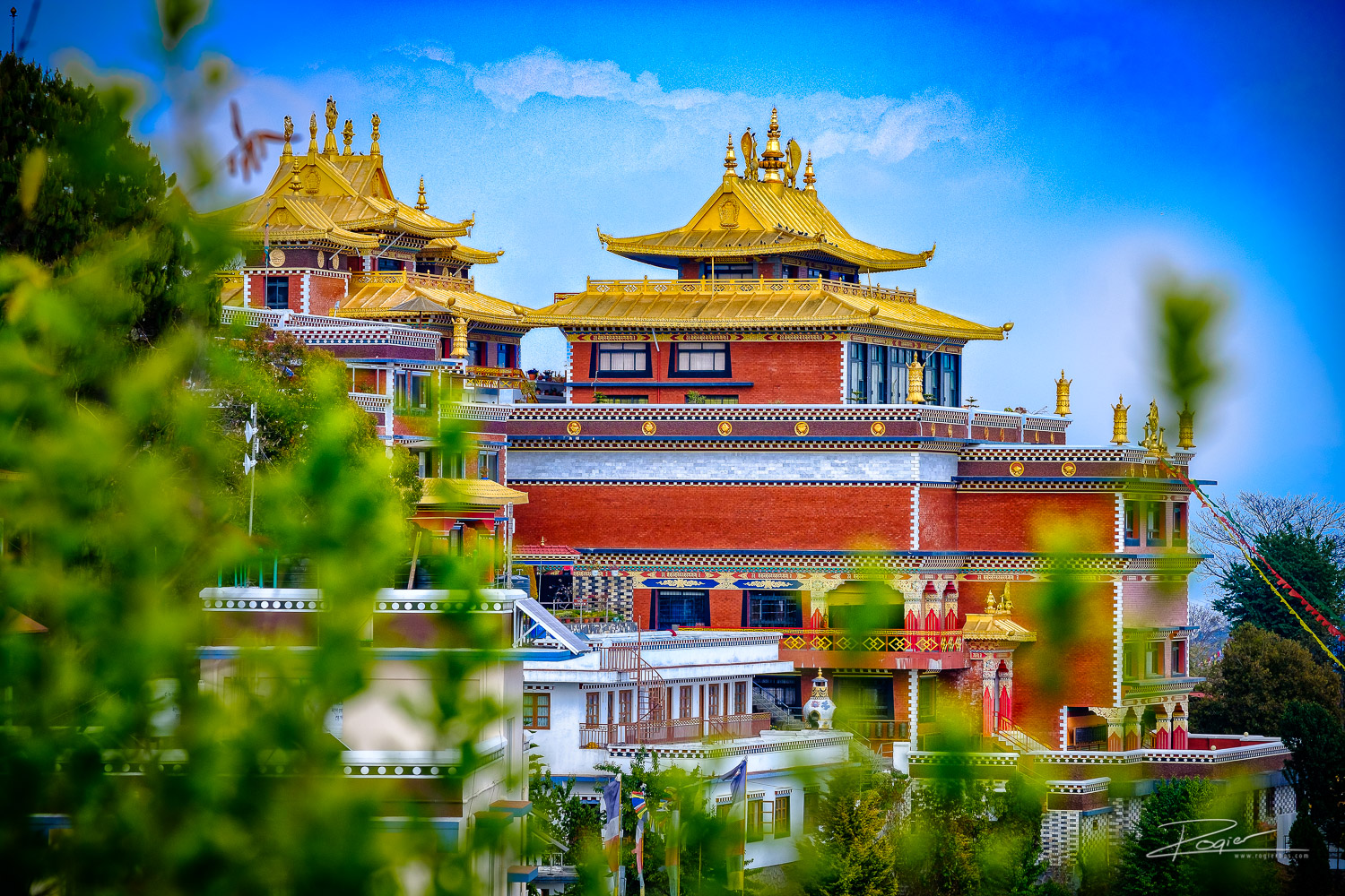
    Nepal tour guide

    Lumba Sumba Pass Trek

    Lumba Sumba Pass Trek is one of Nepal’s most remote and spectacular high-altitude trekking routes, connecting the Kanchenjunga Conservation Area with the Makalu Barun National Park in the eastern Himalayas. This challenging 18-22 day camping trek traverses the rarely explored Lumba Sumba Pass at 5,177 meters (16,985 feet), offering adventurous trekkers an authentic wilderness experience far from crowded trails. Opened only in 2012, this Trek region follows a section of the legendary Great Himalayan Trail (GHT), weaving through diverse landscapes from subtropical forests to high alpine zones while showcasing breathtaking panoramic views of the world’s third and fifth highest peaks—Mount Kanchenjunga and Mount Makalu. Whether you’re seeking an off-the-beaten-path Himalayan adventure with rich cultural encounters, dramatic mountain scenery, and encounters with endangered wildlife like snow leopards and red pandas, this Trek region promises an unforgettable journey through one of the Himalayas’ last truly pristine destinations.

    Travel best places of Nepal
    Travel best places of Nepal


    \nExpand All\nCollapse All

    • \nday\n1

      Arrival in Kathmandu

      • Arrival at the Tribhuvan International Airport.
      • Our representative will greet you with warm regards and escort you to the hotel.
      • Rest of the day is free for making the preparations of the trek that starts the following day.
      • Overnight.

    • \nday\n2

      Kathmandu to Bhadrapur (Flight) to Ilam (Drive)

      Bhadrapur – 93 m / 305 ft – 1 hr

      • 🕒 Drive duration: 5 to 6 hours
      • 🏡 Accommodation: Hotelrn
      • 🍽️ Meals: Breakfast, Lunch and Dinner
      • 📍 Overnight: Bhadrapur Hotel

      Following breakfast, your guide will pick you up at your airport and drive you to Tribhuvan Airport’s domestic terminal in Kathmandu.

      Your guide will board a bus to Illam once more after arriving in Bhadrapur. Your guide will give you an overview of what is ahead after you arrive at Illam. You might also have time to visit this town in the lowlands to the east.

    • \nday\n3

      Bhadrapur to Taplejung (Drive)

      Taplejung – 1820 m / 5971 ft – 9 hrs

      • 🕒 Drive duration: 6 hours
      • 🏡 Accommodation: Hotel
      • 🍽️ Meals: Breakfast, Lunch and Dinner
      • 📍 Overnight: Taplejung Hotel

      Today is a long day on the road as you travel to Taplejung via switchback, dusty, and bumpy roads. On the route, there will be stops for lunch and tea.

      When you get to Taplejung, your camping crew will arrive to get the equipment your guide brought from Kathmandu. They start by preparing dinner for you and setting up the campground.

    • \nday\n4

      Taplejung to Chirwa

      Chirwa – 1270 m / 4166 ft – 6 hrs

      • 🕒 Trek duration: 6 hours
      • 🏡 Accommodation: Tea House
      • 🍽️ Meals included: Breakfast, Lunch, and Dinner
      • 📍 Overnight stay: Chirwa (Camping)

      A day filled with firsts! The first day of serious hiking follows your first breakfast at the campsite! You will probably encounter other hikers over the next few days since you are traveling to Chirwa today, which is also included in the Kanchenjunga Base Camp Trek.

      Today, you will go through meadows and deep woodlands with some steep inclines. Additionally, you will traverse the Tamor River on a suspension bridge.

    • \nday\n5

      Chirwa to Lelep" }, { "@context": "http://schema.org", "@type": "Article", "headline": "Lumba Sumba Pass Trek - 20 Days", "articleBody": "day\n6

      Lelep To Illa Danda

    Illa Danda – 2051 m / 6729 ft – 9 hrs

    • 🕒 Trek duration: 9 hours

    • Accommodation: Camping

    • 🍽️ Meals: Breakfast, Lunch, and Dinner

    • 📍 Overnight: Illa Danda Camping

    The Kanchenjunga Conservation Area is home to numerous types of birds, so you should keep a watch out for them today. You will travel through thick woodlands that may conceal some of the local wildlife, like langur monkeys and musk deer. The rarer creatures can be added to this list at greater elevations.

    You can spend some time at the monastery after ascending uphill and over a suspension bridge before descending to Gowatar hamlet. There is a massive 100-meter (328-foot) waterfall not far from the town. After there, there’s a quick climb to Illa Danda, which offers breathtaking views of the Alps.

  • \nday\n7

    Illa Danda To Selep Kharka

    Selep Kharka – 2525 m / 8284 ft – 9 hrs

    • 🕒 Trek duration: 9 hours

    • Accommodation: Camping

    • 🍽️ Meals: Breakfast, Lunch, and Dinner

    • 📍 Overnight: Selep Kharka Camping

    Today, after crossing a suspension bridge, more meadows and grazing pastures—possibly with sheep and yaks on them—become visible as the dense trees slightly recede. There are breathtaking vistas of the mountains as the trail climbs.

    In reality, your campground for tonight is one of these high-altitude meadows with breathtaking views of the mountains.

  • \nday\n8

    Selep Kharka To Olangchung Gola

    Olangchung Gola – 3208 m / 10524 ft – 7 hrs

    • 🕒 Trek duration: 7 hours

    • Accommodation: Camping

    • 🍽️ Meals: Breakfast, Lunch, and Dinner

    • 📍 Overnight: Olangchung Gola Camping

    As the altitude starts to rise today, the trekking is starting to become a little more strenuous. Enjoy the hike as you bridge the Tamor River once more and pass through more meadows and pastures because you have had plenty of time to get used to it. Additionally, you will hike through rhododendron forests, which are breathtaking in the spring when they blossom.

    Olangchung Gola is a high-altitude meadow that offers breathtaking views of the Kanchenjunga Massif and other snow-capped peaks. You will spend the night camping here and take in the splendor of the surrounding mountains.

  • \nday\n9

    Acclimatization Day

    Olangchung Gola – 3208 m / 10524 ft – 2 hrs

    • 🍽️ Meals: Breakfast, Lunch, and Dinner

    • 📍 Overnight: Olangchung Gola Camping

    Today is an acclimatization day, so get ready for the high altitude that lies ahead.

    Olangchung Gola is home to a monastery that is said to be more than 400 years old. You can take some time to explore it and Olangchung Gola, a Sherpa settlement.

    If not, this is an opportunity to unwind, rest, and consider the future.

  • \nday\n10

    Olangchung Gola To Upper Langmale

    Upper Langmale – 3893 m / 12772 ft – 7 hrs

    • 🕒 Trek duration: 7 hours

    • Accommodation: Camping

    • 🍽️ Meals: Breakfast, Lunch, and Dinner

    • 📍 Overnight: Upper Langmale

    One of the reasons for yesterday’s acclimatization day is that you are ascending significantly in altitude today. There are pastures at the beginning of the trail, but scree and moraines make it rougher. The winds can get strong and cold at this altitude. The trail might even have some snow spots. Both the altitude and the loose or slick ground beneath your feet require caution.

  • \nday\n11

    Upper Langmale To Lumba Sumba Pass Camp

    Lumba Sumba Pass Camp – 4748 m / 15577 ft – 6 hrs

    • 🕒 Trek duration: 6 hours

    • Accommodation: Camping

    • 🍽️ Meals: Breakfast, Lunch, and Dinner

    • 📍 Overnight: Lumba Sumba Pass Camp

    Today, the Tamor River is your route. Maybe you’ll make a lunch stop close to Tangchetar village and then walk the same distance to your overnight destination.

    Over tea and biscuits, your guide will give you an overview of what to expect as you cross the 5,177-meter (16,984.9-foot) Lumba Sumba Pass.

    In order to be ready for tomorrow’s big day, try to get as much sleep as you can tonight.

    Spend the night camping in Lumba Sumba Pass Camp.

  • \nday\n12

    Lumba Sumba Pass Camp To Chauri Kharka

    Chauri Kharka – 4598 m / 15085 ft – 10 hrs

    • 🕒 Trek duration: 10 hours

    • Accommodation: Camping

    • 🍽️ Meals: Breakfast, Lunch, and Dinner

    • 📍 Overnight: Chauri Kharka Camping

    Climbing the Lumba Sumba Pass (5,160 m/16,929 ft) is a long and difficult day. In order to cross the pass before the strong winds arrive, which are often in the late morning, you will need to start early, either at dawn or before dawn.

    You must cross snowfields in the initial section of the journey, which can be dangerous and quite deep.

    Amazing views of the Kanchenjunga Massif, Makalu, Cho Oyu, Lhotse, and numerous more peaks and glaciers can be seen from the top of the pass. As you descend and enter the Makalu Barun region, you will be able to see the Arun Valley.

    Proceed cautiously and gently to your overnight camp.

  • \nday\n13

    Chauri Kharka To Thudam

    Thudam – 3500 m / 11482 ft – 7 hrs

    • 🕒 Trek duration: 7 hours

    • Accommodation: Camping

    • 🍽️ Meals: Breakfast, Lunch, and Dinner

    • 📍 Overnight: Thudam Camping

    Today, the terrain returns to more greenery and a few Sherpa communities as you descend significantly in elevation.

    The Makalu region’s mountain peaks, bamboo woods, and the Chhujung Khola (river) will all be visible. Additionally, you are now quite near the Tibetan border.

  • \nday\n14

    Thudam To Kharka

    Kharka – 2877 m / 9483 ft – 6 hrs

    • 🕒 Trek duration: 6 hours

    • Accommodation: Camping

    • 🍽️ Meals: Breakfast, Lunch, and Dinner

    • 📍 Overnight: Kharka Camping

    Once more, you are following the Chhujung River through bamboo and bushes today. If you’d want, it’s another chance to go bird viewing. Additionally, keep an eye out for red pandas. This elusive creature lives in the Makalu Barun National Park and beyond, but it is extremely difficult to spot.

    Because of the lower elevation, crossing cultivated ground indicates that this area is more populated.

    Overnight at Kharka – camping.

  • \nday\n15

    Kharka To Chyamtang" }, { "@context": "http://schema.org", "@type": "Article", "headline": "Lumba Sumba Pass Trek - 20 Days", "articleBody": "day\n16

    Chyamtang To Hatiya

  • Hatiya – 1595 m / 5232 ft – 6 hrs

    • 🕒 Trek duration: 6 hours

    • Accommodation: Camping

    • 🍽️ Meals: Breakfast, Lunch, and Dinner

    • 📍 Overnight: Hatiya Camping

    When you get to Hatiya in the Arun Valley, you will enter Makalu National Park.

    After descending through cool, shaded woodlands, the terrain is changing to terraced farms and lower foothills.

    The majority of the residents in Hatiya are Bhote. Native tribes from the Himalayan Belt are known as the Bhote or Bhotiya.

  • \nday\n17

    Hatiya To Gola

    Gola – 1128 m / 3700 ft – 6 hrs

    • 🕒 Trek duration: 6 hours

    • Accommodation: Camping

    • 🍽️ Meals: Breakfast, Lunch, and Dinner

    • 📍 Overnight: Gola Camping

    Today, you walk to the tiny settlement of Gola, passing the meeting point of the Arun and Barun rivers.

    Camping at Gola for the night.

  • \nday\n18

    Gola To Hedangna Gadi

    Hedangna Gadi – 1179 m / 3868 ft – 7 hrs

    • 🕒 Trek duration: 7 hours

    • Accommodation: Camping

    • 🍽️ Meals: Breakfast, Lunch, and Dinner

    • 📍 Overnight: Gadhi Camping

    You reach the Gurung settlement of Pathivara after walking over terraced rice fields for a few hours. Unlike the communities you have been viewing on your trip to a remote area, this place has some shops and tea cafes. If they have local cookies, enjoy them here along with a soft drink. Yes, perhaps have two soft drinks as this is the last day of hiking!

    Hedangna Gadhi is reached later on the trek, where you spend the night.

  • \nday\n19

    Hedangna Gadi To Num To Tumlingtar (Drive)

    Tumlingtar – 1020 m / 3346 ft – 4–5 hrs (Drive)

    • 🚐 Drive duration: 4–5 hours

    • 🏨 Accommodation: Hotel

    • 🍽️ Meals: Breakfast, Lunch, and Dinner

    • 📍 Overnight: Tumlingtar

    Following breakfast, it’s a quick walk to Num, where you’ll be picked up by a public jeep and driven to Tumlingtar, where you’ll board a flight to Kathmandu.

    Enjoy your final dinner prepared by your amazing camp cook, your final night with your camping group, and your final conversation with your guide tonight.

  • \nday\n20

    Tumlingtar To Kathmandu (Flight)" } ]

    Our TripAdvisor review :Tour Guide in Nepal

    Content Reviewed By

    Nepal Tour Guide Team Trek & Expedition Pvt. Ltd.

    A licensed trekking and tour operator in Nepal, specializing in unforgettable Himalayan adventures across the Everest, Annapurna, Langtang, and Manaslu regions. Led by experienced local guides, we create safe, personalized, and responsible trekking experiences with expert knowledge of Nepal’s mountains, culture, and trail conditions.

    Legal document:Tour Guide in Nepal
    Nepal tour guide

    Gosaikunda Lake Trek

    Introduction to Gosaikunda Lake Trek

    The Gosaikunda Lake trek is within LangtangNational Park and takes in the high-altitude freshwater lake of Gosaikunda (4,380m). Gosaikunda is not only a Ramsar site (since 2007), meaning that it is a wetland of international importance, but it is also a site considered holy to Buddhists and Hindus.

    On this week-long trek (which can be extended longer), you will have dramatic views of theManaslu range, Ganesh Himal range, Tibetan peaks, andLangtang Lirung, as well as the three lakes of Gosaikunda, Saraswati Kunda, and Bhairab Kunda.

    In Hindu mythology, Gosaikunda is the abode of the gods Shiva and Gauri. It is believed that Lord Shiva formed the lake when he thrust his holy trident into the mountain to extract water to drink. The waters are considered significant during the Janai Purnima festival at the full moon in August when thousands of pilgrims gather.

    The Gosaikunda Lake trek explores the area’s lakes and mountains, following ridges, crossing ravines and suspension bridges, winding through rhododendron, oak, and pine forests, and providing an insight into the people of this area.

    This is the perfect trip for people fascinated by culture, mythology, mountains, and nature but don’t want to trek at high altitudes.

    Our TripAdvisor review :Tour Guide in Nepal

    Content Reviewed By

    Nepal Tour Guide Team Trek & Expedition Pvt. Ltd.

    A licensed trekking and tour operator in Nepal, specializing in unforgettable Himalayan adventures across the Everest, Annapurna, Langtang, and Manaslu regions. Led by experienced local guides, we create safe, personalized, and responsible trekking experiences with expert knowledge of Nepal’s mountains, culture, and trail conditions.

    Legal document:Tour Guide in Nepal
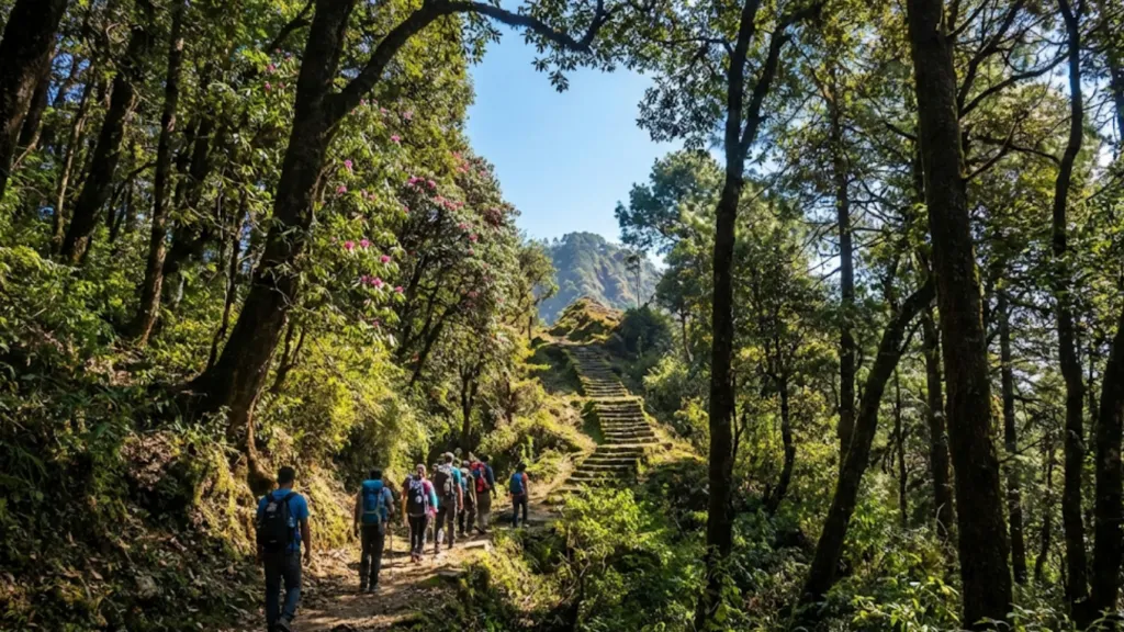
    Nepal tour guide

    Tsum Valley Trek Itinerary and Cost

    Tsum Valley Trek Overview

    Why not travel via the secluded and remote Tsum Valley if you’re searching for an alternative Nepal Himalayan trek? Since it has only been around for less than 20 years, trekkers have had limited access to it, making it less well-known and accessible than traditional treks in other parts of the nation.

    The Tsum Valley Trek exposes us to Tibetan culture and way of life through the many gompas and monasteries we can traverse, leading us through some of the most stunning landscapes all the way to the Tibet-Nepal border. The mountain scenery is unique, and the trails are mostly over 3,000 meters (9,842 feet), as we could expect so far north. Himalchuli (7,893 m / 25,895 ft) and Mount Manaslu itself (8,163 m / 26,781 ft) are two of them. Continue reading if you think this is a destination you would love to visit.

    Tsum Valley Trek Route

    The trek to Tsum valley has its starting point in Kathmandu. Our journey navigates west bound via Prithvi highway for 110 kms prior to reaching Aabu Khaireni. The roadway branches off at Aabu Khaireni and heads north. We then arrive at the compact community of Gorkha district, Aarughat. Aarughat secludes Dhading district from Gorkha and dirt road starts from hereon. Our drive will largely tail along Budhi Gandaki river and so will our trek. We navigate through small Gurung villages to reach Machhakhola. Our trekking days commences from Machhakhola.

    For the initial 3 days, our expedition will be a rollercoaster ride down the route paved beside raging Budhi Gandaki river. This river serves as one of the prominent tributaries of the Saptagandaki river system. Your walk will follow along several small rural villages that cater as teahouses for trekkers. Tsum Valley trek uncovers villages like: Machhakhola ,Tatopani, Dovan, Jagaat, Salleri, Phillim, before reaching Lokpa village. And continue to Chumling, Chhokang Paro ,Rana gaon, Rachen Gumba, Chhule / Nile and finally to Mu Gumpa.

    Pathway to Manaslu Circuit Trek diverges at Lokpa. Another major river, Syar river, meets with Budhi Gandaki at Lokpa. Our trekking days then are spent walking down the route paved by Syar river. This river has a sacred significance and provides an agricultural source for the Tsumba people. Tsumba people are popularly known for their committed devotion towards ethnic Buddhist culture. You will encounter several traces of Buddhist heritage in the Tsum area of this trek. Dotted with divine monasteries, the trail hereafter is filled with spirituality and history. Rachenn Monastery, Milarepa Piren Phu, and the most primordial monastery of Tsum valley, Mu Gompaa, will fill your trek with spiritual enlightenment. Your trekking adventure will end at Mu Gompa and then we retrace our footsteps back.

    What Not to miss in Tsum Valley Trek

    Mu Gompa:

    Mu Gompa is the oldest Buddhist structure in the Manaslu region. The 3700-meter-high Mu Gompa is home to historic carvings of Tibetan monasteries. Bon Buddhist adherents have long held this location in high regard. Ancient paintings, wooden doors and pillars, golden-colored artwork, wooden floors, and sculptures of Lord Buddha are all shown in the monastery. The Dalai Lama and other revered monks are depicted on the sides of the main statue, which is placed at the monastery’s northern end. Every day, the monastery holds a procession that includes sacred prayers and offerings. High mountains encircle the monastery on all sides, while the Syar River flows through the center.

    Rachen Nunnery:

    The Rachen Nunnery in Tsum Valley is yet another amazing place to see. Rachen Gompa village is home to this nunnery, which is a symbol of both spirituality and cultural history. This nunnery, which was constructed according to a Tibetan architectural blueprint, is inhabited by Buddhist nuns who have made prayer, study, and contemplation their life’s work. Upon entering this area, you will feel a sensation of spiritual enlightenment. The place’s ancient roofs, pillars, and walls will transport you back in time.

    Milarepa Cave

    Milarepa Cave is located between Rachen Gompa and Mu Gompa. Religious history about Milarepa, Tibet’s most famous poet and yogi, may be found in this cave. For members of Buddhist communities, the cave is a sacred site, although appearing commonplace to outsiders. The cave, which is remote from a neighboring village, is thought to have served as Milarepa’s meditation area in the eleventh century. Tibetan Buddhism has a long history in this cave, which continues to arouse spiritual energy today.

    Chhokang Paro

    ​​On your journey to Tsum Valley, you will come across a number of Buddhist communities. Nevertheless, Chhokang Paro is a picture-perfect example of a Buddhist community in the region. This small hamlet located in between Chumling and Racchen Gompa reflects a typical Buddhist village. The trail led from the center of buildings made of stone and mud. The village is decorated with prayer flags, mani walls, and chhortens.

    Gumba Lungdang

    In the Tsum Valley Trek, Gumba Lungdang is another noteworthy Buddhist cultural site. This ancient monastery is situated between Ganesh Himal Base Camp and Dumje. The outside of this monastery features elaborate carvings in a distinctive Tibetan style. Looking at this monastery will open your eyes to a completely different view of Bon Buddhism. A humorous mountain vista that includes Ganesh I (7422m), Ganesh II (6908m), Voke Peak (4617m), and Ganesh IV (6908m) envelops it. Work with our knowledgeable staff to plan your Tsum Valley itinerary so that you can see these undiscovered locations.

    Natural Hot Spring

    Most of Nepal’s core Himalayan regions have natural hot springs that come up out of the earth. Manaslu has one of these natural hot springs, just like Annapura, Langtang, and Rolwaling. Tatopani Hot Spring, located between Macchakhola and Jagat on the Budhi Gandaki River, is believed to contain mineral-rich waters that help cure skin-related problems.

    Tsum people:

    The Tsum people, indigenous to Tsum Valley, are believed to have migrated from Tibet long ago. These people have lived in the Tsum Valley since the beginning of time since it is a commercial route connecting Tibet and the lower regions of the Gorkha district. Their religious and cultural customs are quite similar to Tibetan Buddhism, which is practiced in many parts of Nepal, such as Upper Mustang, Upper Dolpo, Humla, and other regions that border Tibet. The Tsumba people celebrate a number of festivals, which you can see if you’re lucky enough. Lhosar, Saga Dawa, Dumje and other festivals are celebrated in Tsum valley and are observed with full of energy and passion by the Tsumba people. Please consult with Himalaya Trip to plan the best time for Tsum Valley that coincides with these festival dates.

    Ganesh Himal Base Camp

    Ganesh Himal Base Camp is reached by the eastbound path that branches out from Dumje. It is at this base camp that the Ganesh Himal trip begins. At 4200 meters, this base camp is situated just beneath the glittering Ganesh range peaks. “Ganesh” is the name of a revered Hindu god whose head is shaped like an elephant. The name comes from the fact that the mountain summit resembles the face of this Hindu god. You will have a wondrous time at Ganesh Himal base camp as it is located amidst gigantic mountains. We suggest you buy a detailed Tsum Valley trek map to not miss important points of interest. The standard itinerary of Tsum valley trekking does not include Ganesh Himal Base Camp trek. If you want to add this side trip, please inquire with us.

  • Nepal Tourism Activities
    chat-in-website
    Need Help? Chat with us
    chat-in-website
    Need Help? Chat with us